Subject: Southwestern United States, Texas and Mexico
Period: 1842 (dated)
Publication:
Color: Hand Color
Size:
15.5 x 12 inches
39.4 x 30.5 cm
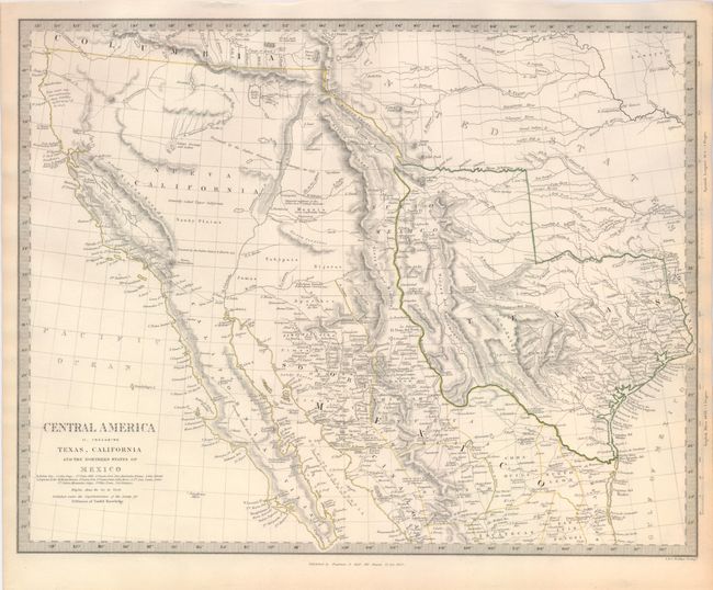
This excellent map covers the southwestern United States just a few years before Mexico lost the region in the Mexican/American War. Texas is shown as an Independent Republic with its panhandle extending well north up to Spanish Peaks. Excellent detail throughout Texas shows many towns and villages, roads and trails, topography, and watershed. All of the Southwest and California are here noted as "Generally called Upper California". Large swamps and lakes in the Great Basin drain through a complex R. Buenaventura system. The map displays excellent detail throughout and includes Houston, Austin, San Antonio as well as forts, Indian tribes, etc. There are interesting notations; a Supposed Petrified Forest in the western part of Texas, Supposed residence of the Aztecs in 12th century (Humboldt ) in the Moquis (Hopi) region of present-day Arizona. Published by Chapman and Hall.
References: Wheat [TMW] #460.
Condition: A
Fine impression and original hand coloring in outline. Margin edges toned or soiled.