Subject: United States & Mexico
Period: 1790-1850 (circa)
Publication:
Color:
Nice lot of maps focused on the southwestern part of North America. The maps cover an interesting period in the mapping of the region, from the latter part of the 18th and early part of the 19th century, and provide a great look at the evolving cartographic knowledge.
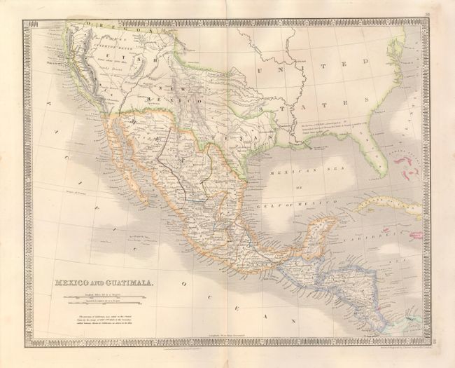
1) Mexico and Guatimala, drawn and engraved by John Dower and published by Henry Teesdale, circa 1850 (16.3 x 13"), outline color. This map focuses on the acquisitions made by the United States at the conclusion of the Mexican/American War in 1848. The rivers in the western U.S. are fairly accurate; the Great Interior Basin Extent about 1800 Miles and Sandy Desert destitute of Water is prominently noted. The gold region in California is shown in yellow outline color. The states of Mexico are delineated and there is good detail throughout the map.
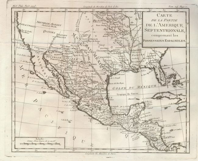
2) Carte de la Partie de l'Amerique, Septentrionale, Comprenant les Possessions Espagnoles by Brion de la Tour, from L'Histoire Universelle, Paris, ca. 1790 (10.8 x 8.6") uncolored. This map focuses on the Spanish possessions in North America, taking in Florida and the entire southwestern part of the continent, which is completely blank and labeled Nouvelle Albion Suivant Drake and Quivira. The Indian tribes of the Southwest and the Mississippi River valley are noted. There is good detail throughout Mexico and Central America.
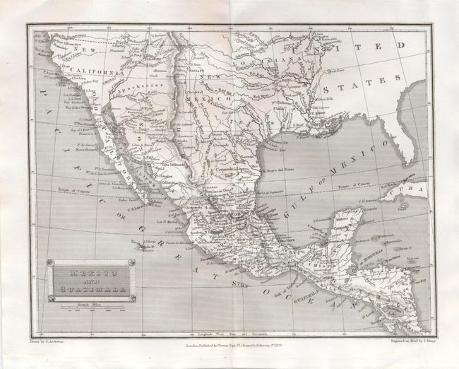
3) Mexico and Guatimala drawn by J. Assheton, engraved by J. Shury and published by Thomas Tegg, London, 1829 (10.2 x 8") uncolored. This map provides a great amount of detail in the Transmississppi West. The boundary between the United States and New Mexico is undefined. In New California there are two westward flowing rivers shown with dotted lines: Riv. Buenaventura and Riv. S. Felipe. A mountain range runs like a spine through the length of the map.
References:
Condition: A
All very good; first with a short fold separation not affecting the map.