Subject: Southern United States, Mexico and Central America
Period: 1747 (circa)
Publication:
Color: Black & White
Size:
16.5 x 13.8 inches
41.9 x 35.1 cm
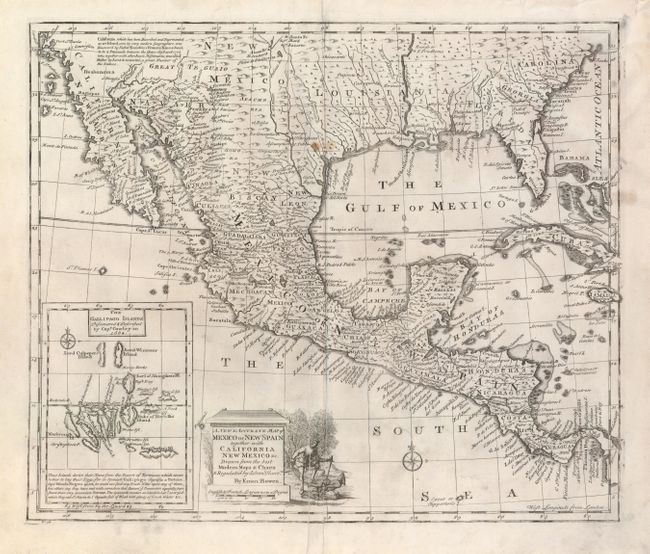
A nicely engraved map covering the region from Carolina to California, as well as all of Mexico, Central America, Cuba and Jamaica. A descriptive legend in southern California gives credit to Father Kino for discovering that California is a peninsula rather than an island. There are a number of settlements along the Rio Grande as well as Cenis Fort and several settlements in Texas. Inset at the lower left has a great little map of the Galapagos Islands, including some interesting notes on their discovery in 1684 and the origin of the name. The title cartouche features a vignette of a man subduing a pair of natives.
References: Wheat (TMW) #126.
Condition: B+
This near fine example has full margins and a nice impression. A couple very thin printer's creases, one next to the lower centerfold and a short one in the Pacific.