Subject: Washington
Period: 1859 (dated)
Publication: Senate Ex. Doc No. 2, 1st Session, 36th Congress
Color: Hand Color
Size:
28 x 22 inches
71.1 x 55.9 cm
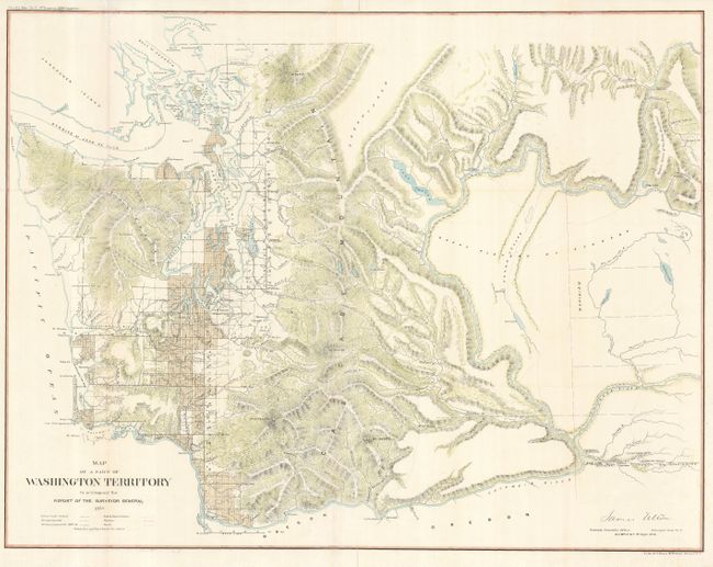
This is an early and uncommon map of Washington Territory that extends south to Oregon and east beyond Walla Walla to the Western limits of the Rocky Mountains. It is a detailed map that provides information on the extent and status of surveying in the territory and shows watershed, mountains in hachure, Indian and military reservations, and forts. This edition pre-dates the display of gold regions that first appear on the 1862 issue. Signed in the plate by James Wilson, Surveyor General at Olympia on Sept. 1st, 1859.
Washington Territory was created in 1853 and despite Indian hostilities (Yakima Wars 1855-56), some surveying progress was achieved west of the Cascades. Construction of several Army forts (shown on the map) and military roads continued periodically, supporting further survey efforts. The outbreak of the Spokane War (1858-59) did hamper surveyors and the map reflects a large part of the territory as unsurveyed.
References:
Condition: B+
Originally folded, now flattened with folds reinforced with tissue on verso.