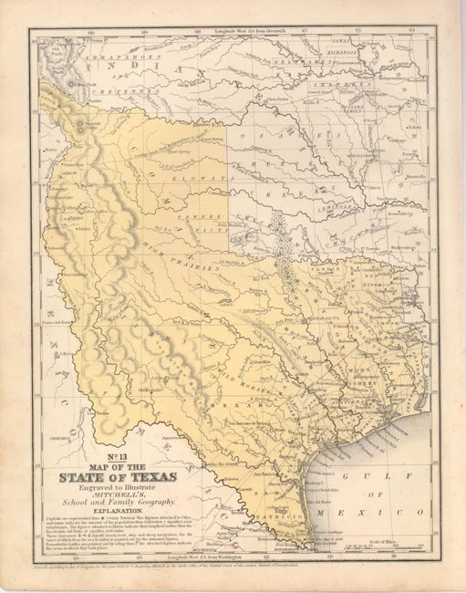
Subject: Texas
Period: 1846 (dated)
Publication: Mitchell's School and Family Geography
Color: Hand Color
Size:
8 x 10.5 inches
20.3 x 26.7 cm
This map features the "stovepipe" configuration showing Texas at its largest extent when first admitted to the Union. The western boundary is at the Rio Grande del Norte, putting Santa Fe in Texas. Part of Texas continues to the northwest above Taos in an area labeled the Green Mountains. This edition is the first to name Dallas. There are no counties formed west of about 98°, ending at Gonzales and Gollard counties. There is a large unorganized Bexar region above San Antonio de Bexar which contains a region labeled Wild Horses and a silver mine shown further north. In the western region a number of Indian Tribes are named. This is the most desirable map of Texas from the Mitchell school geographies. A nice example.
References:
Condition: A
Nice example with original color and full margins. A little marginal spotting or foxing with a few small spots in blank area at lower left, still very good.