Subject: North and South Carolina, Civil War
Period: 1866 (published)
Publication: Report to the Committee on the Conduct of the War
Color: Black & White
This historical set of maps portrays various Civil War campaigns as issued in Major General J.G. Foster's report. These seven maps were published by Bowen & Co. of Philadelphia soon after the end of hostilities. The lot includes:
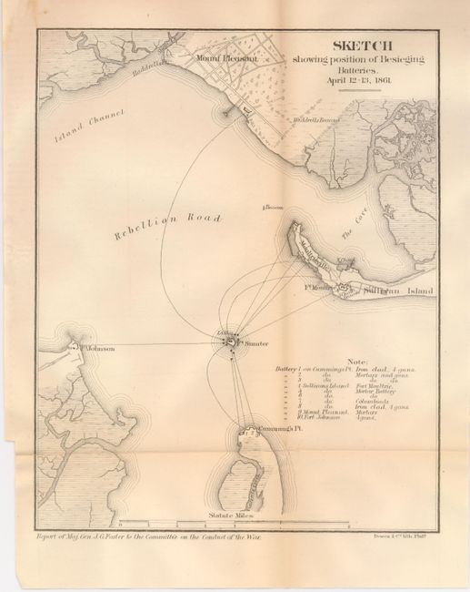
1) Sketch showing position of Besieging Batteries April 12-13, 1861. (9.1 x 7.3") Hint of fold toning and intersection split closed on verso. (B+) Ref: Stephenson 386.5.
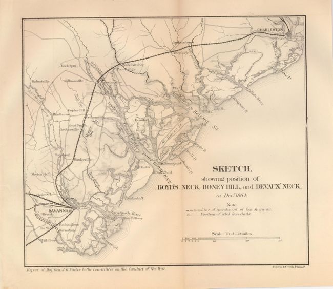
2) Sketch showing position of Boyd's Neck, Honey Hill, and Devaux' Neck, in Decr. 1864. (8.4 x 7.3"). Hint of fold toning. (A). Ref: Stephenson 359.5.
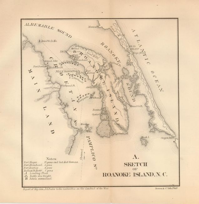
3) A. Sketch of Roanoke Island, N. C. (7 x 6.6"). (A+). Ref: Stephenson 317.1.
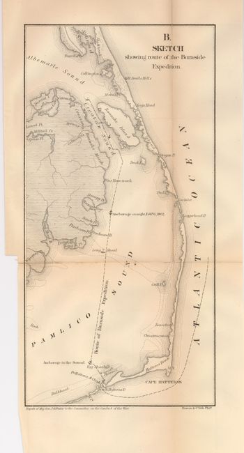
4) B. Sketch showing route of the Burnside Expedition (6.1 x 12.1"). Lightly toned along folds and a long fold separation. (B). Ref: Stephenson 317.12.
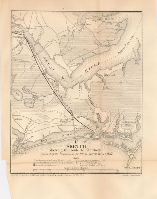
5) C. Sketch showing the route to Newbern, pursued by the Burnside Expedition, March 13, & 14, 1862. (6.8 x 8.5"). Small fold split repaired with archival tape on verso (B+). Ref: Stephenson 316.8.
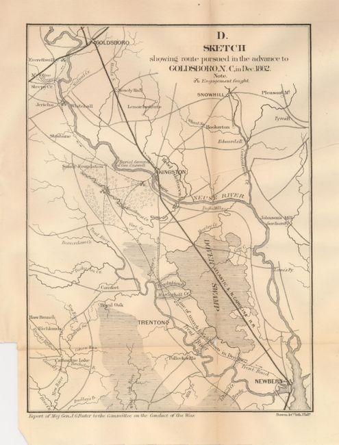
6) D. Sketch showing the route pursued in the advance to Goldsboro, N. C. in Dec. 1862. (7 x 9.5"). A couple small fold splits (B+). Ref: Stephenson 316.5.
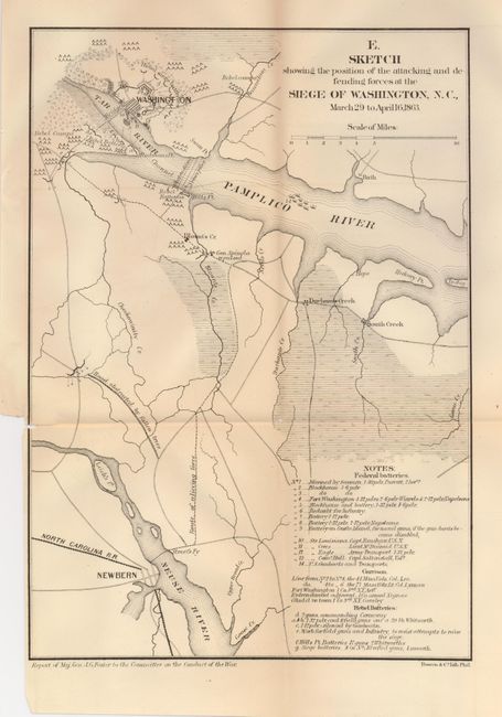
7) E. Sketch showing the position of the attacking and defending forces at the Siege of Washington, N. C. March 29 to April 16, 1863. (8.3 x 11.8"). Small fold intersection split and short split at right repaired on verso with archival tape. (B+) Ref: Stephenson 317.4.
References:
Condition:
See individual descriptions.