Catalog Archive
Auction 125, Lot 305

"[Lot of 6 Gettysburg, Civil War maps]", U.S. Government

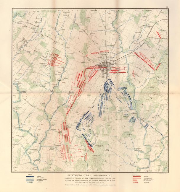
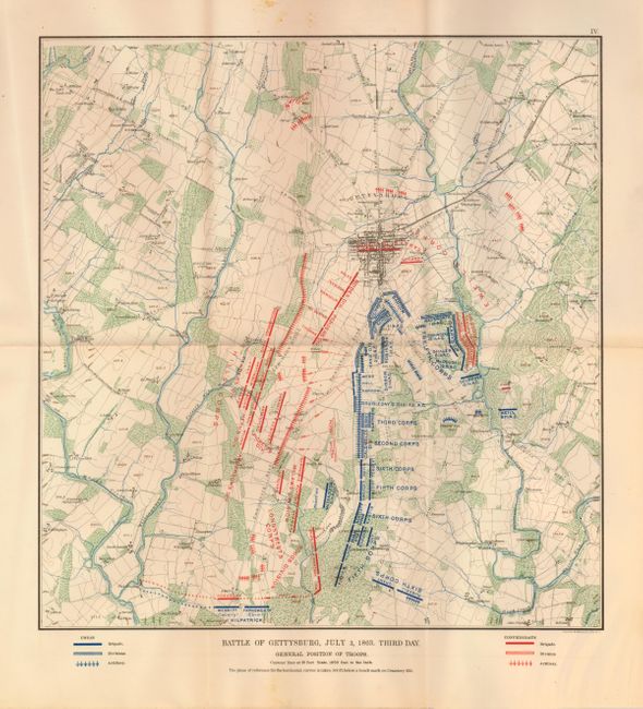
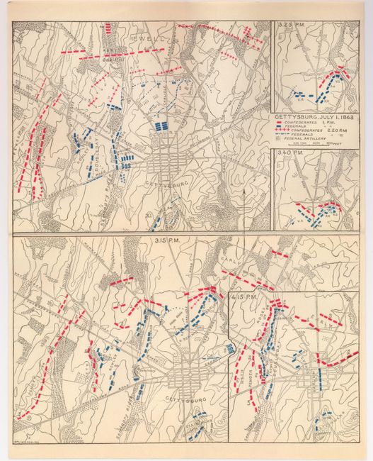
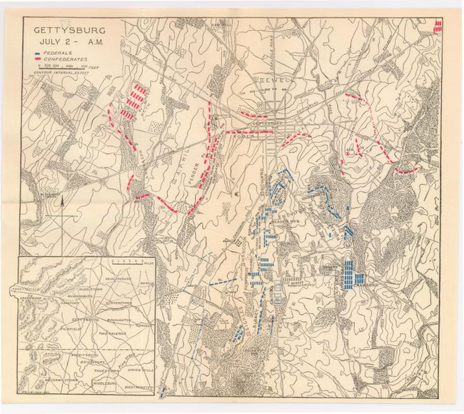
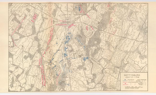
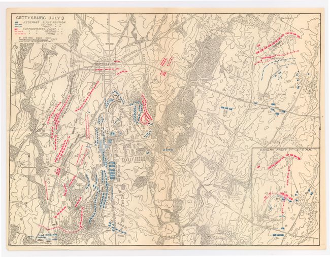
Subject: Gettysburg, Pennsylvania - Civil War

Period: 1892 (circa)

Publication:

Color: Printed Color

Size:
See Description
Download High Resolution Image
(or just click on image to launch the Zoom viewer)

A very nice Civil War lot pf six maps that focus on the Gettysburg battle. The first two are from the Official Atlas of the Civil War, published in 1892 . The Troop locations on these maps are shown in blue for the Union and red for the Confederates. The last four maps are from an unknown source.

1) Gettysburg, July 2, 1863. -- Second Day. (14 x 14.8")
2) Battle of Gettysburg, July 3, 1863. Third Day. (14 x 14.8")
3) Gettysburg, July 1, 1863 (8.5 x 10.3")
4) Gettysburg July 2 -- A.M. (9.5 x 8.5")
5) Gettysburg July 2 -- P.M (13.5 x 8.4")
6) Gettysburg July 3 (11.3 x 8.5")

References:

Condition: A

Estimate: $100 - $140

Sold for: $120

Closed on 9/24/2008

Archived