Subject: Oregon
Period: 1884 (dated)
Publication: Senate Doc. #60, 49th Congress, 2nd Session
Color: Printed Color
Size:
30 x 22.5 inches
76.2 x 57.2 cm
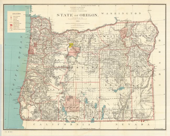
This finely engraved and delicately colored map was drawn by William Naylor under the supervision of G.P. Strum, Principle Draughtsman, N.C. McFarland, Commissioner. Excellent detail from the Cascade Mountains west to the coast notes all towns and villages, roads, and railroads, with watershed and topography shown in hachure. The legend identifies military posts, Indian reservations, completed railroads, railroad land grants, townships and townships not yet subdivided. The granted and indemnity limits of military wagon roads are illustrated. Grid along the bottom shows longitude west from Washington. Lithography and printing by the renowned firm of Julius Bien in New York City. Also included in this lot is the original six-page report which refers to the map.
References:
Condition: A
Issued folding, now pressed and backed with archival tissue. A little toning offshore in the Pacific Ocean, otherwise a fine example.