Subject: Oklahoma
Period: 1898 (dated)
Publication:
Color: Black & White
Size:
17.8 x 19.8 inches
45.2 x 50.3 cm
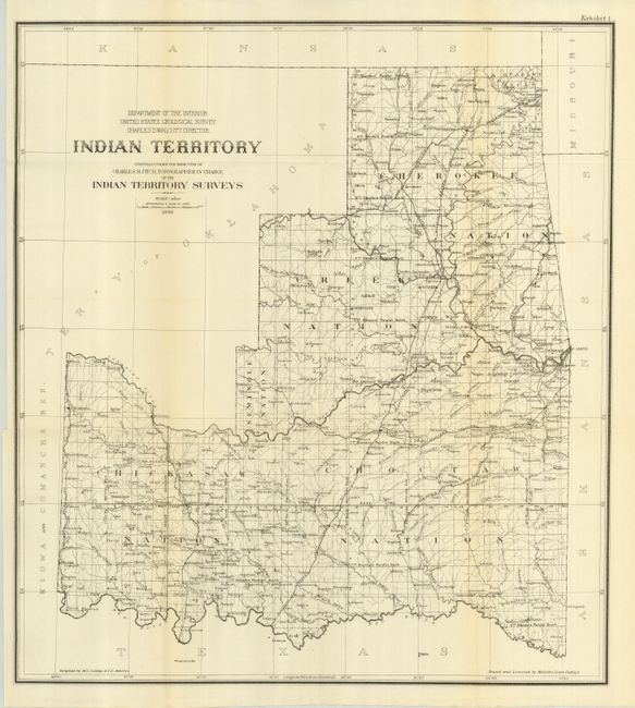
This uncommon map matches the configuration of the rare State of Sequoyah, which the Indian Nations attempted to create in 1905 in an effort to thwart the expansive tendencies of the United States. It is also similar to the rare 1896 Senate edition which was issued in printed color. The regions of the Chickasaw, Choctaw, Creek, Seminole, Cherokee, and several other Indian tribes are named. The Territory of Okalahoma hovers ominously in the northwest. Fitch was the topographer in charge of the Indian Territory Surveys. Compiled and drawn by Malcolm Lloyd Cudlipp & F.E. Matthes, Cudlipp also performed the tracing and lettering. Lithography by the Norris Peters Company. A most desirable map for which, in this Senate format, we find no prior sales records. The same map was published two months earlier as House Document #169 with the slightly different title "Progress of Survey and Subdivision Indian Territory."
References:
Condition: A+
Folding as issued.