Subject: New Hampshire
Period: 1887 (dated)
Publication:
Color: Printed Color
Size:
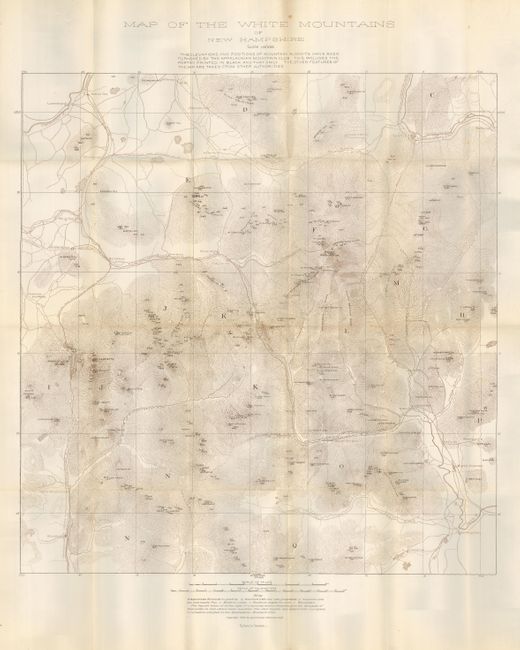
21.5 x 22.7 inches
54.6 x 57.7 cm
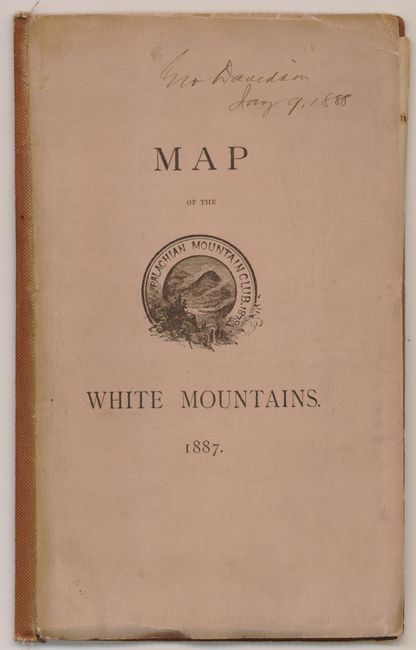
An uncommon pocket map published by the Appalachian Mountain Club. The topographical map shows the terrain in fine hachure at a scale of 1.6 miles per inch. Highly detailed, it locates towns and villages, many geographical features and more. Names White Horse Ledge, Carriage Road Ridge, scores of mountains, lakes and rivers. It extends to show Gorham, Bethlehem, Jefferson Hill, North Conway, and Woodstock. Copyright by the Appalachian Mountain Club and printed by Forbes Co., Boston. Folds into soft covers (5" x 7.8") with "For Sale by Clarke and Carruth…Price, 50 cents" on back.
References:
Condition: A
The map is fine and printed on thick paper with occasional intersection splits; inevitable on paper this thick. Paper covers are partially split with binding cloth added to spine. Old owner's inscription on front cover in light ink above title.