Subject: Missouri
Period: 1816 (dated)
Publication: American State Papers
Color: Hand Color
Size:
15 x 18 inches
38.1 x 45.7 cm
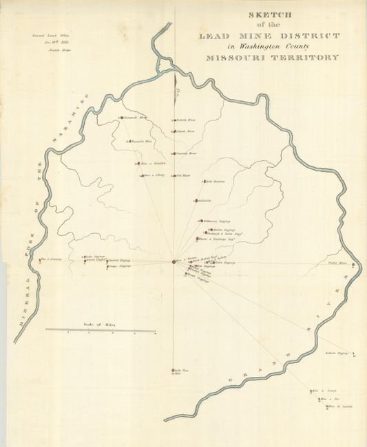
A detailed map locates 33 diggings and mines along the Grand River near present-day Potosi and Washington State Park. Numerous mines are named including Old Mine's and Belle Fontaine, both on today's maps, Scott's Diggings, Mine a Liberty, Renault's Mine; scores of diggings include Silver's, Perry's, Wilkinson and many more. The map is bounded on the west by the Mineral Fork of the Maramieg River and on the east by the Grand River. On a scale of approximately two miles per inch. Many paper records of the early Congresses were destroyed when the Capital burned in 1814. Congress reprinted selected maps and documents from the first 14 Congresses in this publication. Dated 1816, but reprinted in the American State Papers, 1832-38. Not in Marcou & Marcou.
References:
Condition: A
Issued folding, now pressed and backed with archival tissue. A couple small spots in upper portion else fine.