Subject: Florida
Period: 1856 (dated)
Publication:
Color: Black & White
Size:
23 x 25 inches
58.4 x 63.5 cm
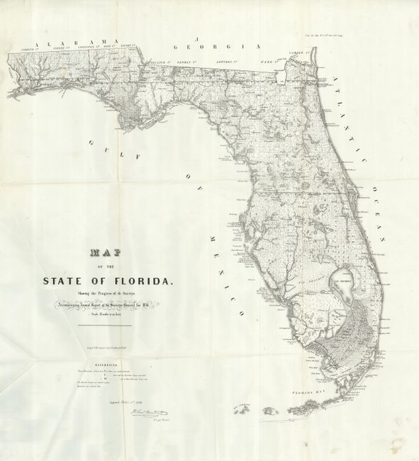
This is an early state survey map drawn on a scale of 12 miles to the inch that was published in the 1856 Annual Report of the Survey General. It details the topography, vegetation, towns, cities, forts, rivers, lakes, swamps and many early trails and roads. Most of the state has been surveyed. Area extends to show scores of keys, Dry Tortugas Island and Ft. Jefferson, and locates Ft. Lauderdale, Boca Rabones, Key Biscayne, and much, much more. It is signed in the plate by John Westcott, Surveyor General. Published by Wagner & McGuigan's Lithography. A beautiful example.
References:
Condition: A
Folding as issued. This example is very nearly fine with only one or two small spots. Bright impression on clean paper.