Subject: Florida
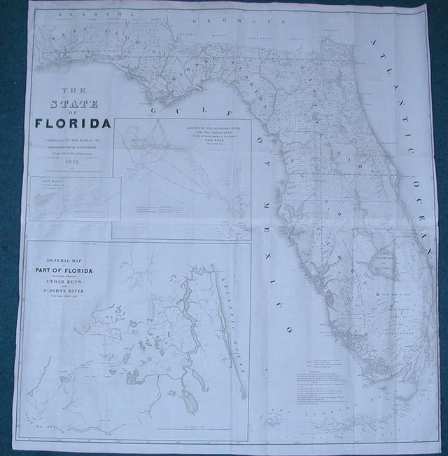
Period: 1846 (dated)
Publication:
Color: Black & White
Size:
40 x 42 inches
101.6 x 106.7 cm
A very large and comprehensive map of Florida showing the status of Public Land Surveys, rivers, lakes, coastal islands, towns, army posts, trails, etc. Inset maps: "Key West as surveyed February 1829"; "Mouths of Swanee R. and Cedar Keys showing the Western terminus of a proposed railroad"; and "A General Map of part of Florida included between Cedar Keys and St. John's River." This incredible chart is filled with detail. Drawn by J. Goldsborough Bruff and finely engraved by D. McClelland of the Topographical Engineers.
References:
Condition: B
Issued folding. There is slight loss of neatline at right from the binding trim, which has been replaced with paper added to the margin. Otherwise it is in remarkable condition with very little toning.