Subject: California, San Francisco
Period: 1849 (dated)
Publication: Senate Ex Doc 18, 31st Cong 1st Session
Color: Hand Color
Size:
19 x 24.8 inches
48.3 x 63 cm
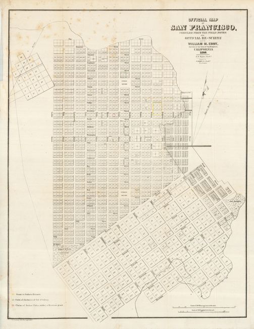
A scarce and seldom offered street map of San Francisco. It appears to be pre-landfill, with some planned tracts drawn in the bay between Montgomery Fort and the Government Reserve, and another section including Bryant and Brannan Streets. Terrific detail includes individual tracts numbered and many streets named. The Yerba Buena Cemetery, a Government Reserve, two Public Squares, Portsmith Square, and Fort Montgomery are identified, but no buildings are shown. A colored legend, at lower left, keys to the map and locates a grant to Senora Briones, the claims of the heirs of Col. J. A. King and a claim of Senor Pana under a Mexican Grant. Howes attributes the map to the report "Land Titles in California" by William C. Jones. Drawn by S. W. Higgins and copied by P.M. McGill, C.E. He notes that not all copies of the report contained the map.
References: Howes #248; Phillips (M) p. 776; cf California 49 pp. 64.
Condition: B+
Issued folding, now pressed and backed with archival tissue. Binding trim removed 2" of neatline that has been repaired with paper and neatline added in facsimile. A little foxing at upper left.