Subject: Southwestern United States - New Mexico
Period: 1853 (dated)
Publication: New York Illustrated News
Color: Black & White
Size:
9.2 x 5.9 inches
23.4 x 15 cm
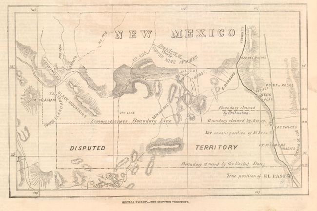
This map shows the disputed region of southern New Mexico (Mesilla Valley) that arose from the poorly worded boundary treaty of 1847. New Mexico's governor William Carr Lane issued a proclamation from Dona Anna on March 13th to take possession of the region. The map shows the boundary lines as claimed by the United States and Mexico, as well as Chihnahna's claims. Also of interest are the "True position of El Paso" and the "Erroneous position of El Paso," the Copper Mine Apaches, Ben Moore, Ft. WFBST, Mt. Graham (in today's Arizona), Ojo del Muerto, and more. On a full page (#357) of the June 4, 1853 issue of the New York Illustrated News. This publication is quite rare and this is from its first year of publication.
References:
Condition: A
A smudge in blank margin at right.