Subject: Northwestern United States
Period: 1837 (published)
Publication: The Rocky Mountains…
Color: Black & White
Size:
16.3 x 17.3 inches
41.4 x 43.9 cm
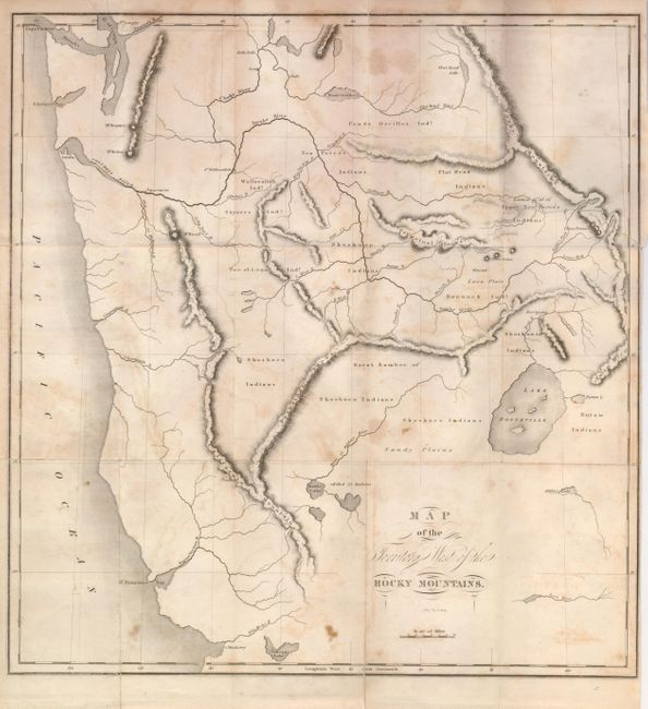
This map of the West was published in Washington Irving's important book based on the explorations of Capt. Bonneville. The map extends from Monterey in the southwest to Flathead Lake in today's Montana. The Great Salt Lake is named Lake Bonneville, with no mention of Utah Lake. The map locates and names the Salmon, Boise, Malade, Snake, Columbia and Flat Head rivers. Several dead-end rivers and lakes are shown in the Great Basin area including Lost River, Ashley's Lake, Battle Lake, and the Mary or Ogden's River. It describes the territories of the Shoshoco, Eutaw, Too-el-Iican, Skynses, Flat Head, Pends Oreilles, Wallawallah and Bannack Indians. Of navigational importance to the western immigrants are the three buttes in Idaho. Among his discoveries, Bonneville is credited with finding the Humboldt and San Joaquin Rivers. An important map for any collector of western material.
References: Wheat (TMW) #424.
Condition: B
Folding, as issued. Some scattered foxing and a tear enters map from binding trim about 3", closed on verso.