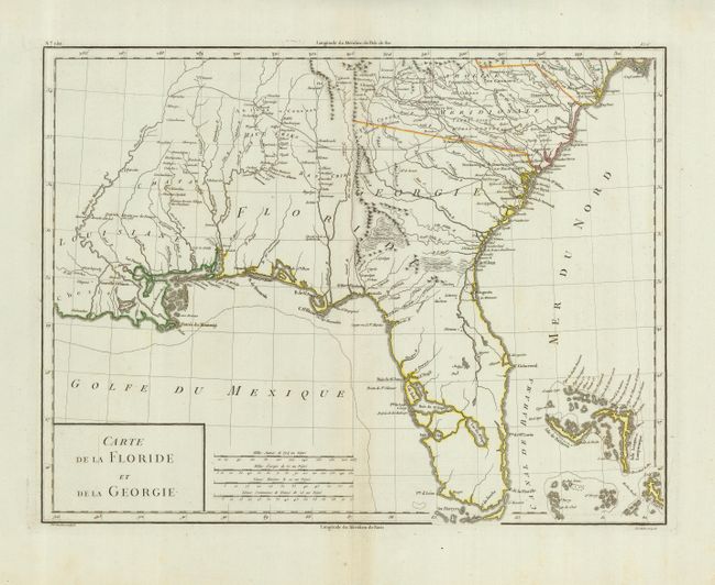
Subject: Southern United States
Period: 1785 (circa)
Publication:
Color: Hand Color
Size:
16.8 x 12.8 inches
42.7 x 32.5 cm
Handsome early map covering from South Carolina to Florida and the Bahamas and much of the lower Mississippi valley. The map depicts Florida during the period when it was controlled by the Spanish. However, there are no engraved political divisions indicating the mapmaker's bias toward either the territorial claims of Spain or the United States. The map provides an excellent view of the Gulf Coast with a dramatically oversized Tampa Bay (Baie de St. Esprit), reflecting the limits of contemporary knowledge of the region. Numerous Indian villages are located and roads are shown connecting early settlements. The Bahamas are also well delineated.
References:
Condition: A
Hinge tape remnants on verso.