Subject: Colonial Southeast
Period: 1773 (dated)
Publication: Raynal's Atlas Portatiff
Color: Hand Color
Size:
11 x 7.3 inches
27.9 x 18.5 cm
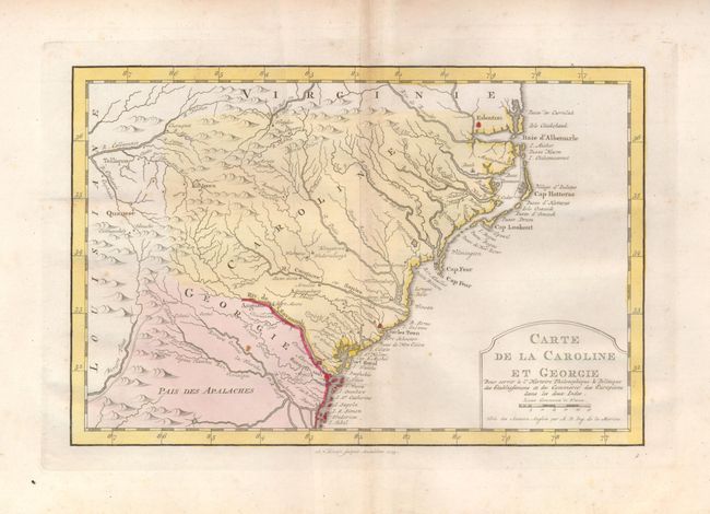
Delicately engraved map of the colonies of Carolina (not separated into North and South) and Georgia from Albemarle Sound to the Alatamaha River. It probably owes its origin to the 1752 map of the region by Emanuel Bowen. Numerous English settlements along the coast and Indian villages are located throughout, including a number west of the Appalachian Mountains. There is more detail in the area west of the Blue Ridge than in many other maps of the period. The map shows a rudimentary course of the Tennessee River in the northwestern section of the map. Engraved by A. van Krevelt and published in an uncommon Dutch edition.
References: cf Cummings (SE) #311; cf Sellers & van Ee #1384.
Condition: B+
Nice original color with a couple of faint spots and a light crease.