Catalog Archive
Auction 125, Lot 187

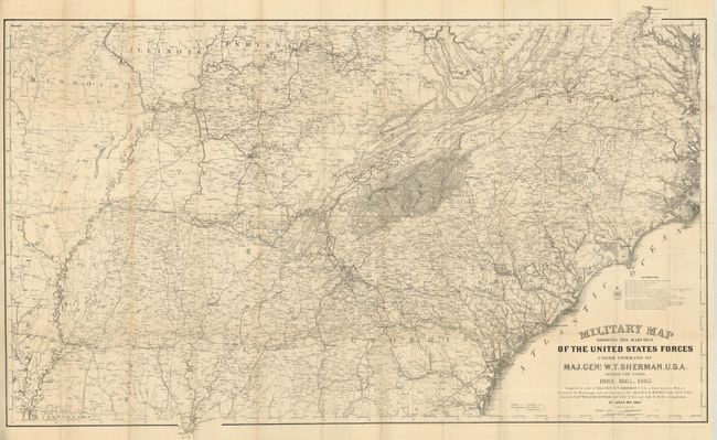
"Military Map Showing the Marches of the United States Forces Under the Command of Maj. Genl. W.T. Sherman U.S.A. during the Years 1863, 1864, and 1865…", U.S. Army

Subject: Southern United States

Period: 1865 (dated)

Publication:

Color: Black & White

Size:
45 x 27 inches
114.3 x 68.6 cm
Download High Resolution Image
(or just click on image to launch the Zoom viewer)

This is the original and full sized version drawn by Captain William Kossak in St. Louis, MO and printed by the Ferd. Mayer company of New York during the Civil War. The map was compiled under the direction of Bvt. Maj. W.L.B. Jenney by order of General Sherman. It covers the region bounded by Mobile in the south, Washington DC and St. Louis in the north, east to Chesapeake Bay and as far west as Little Rock. Absolutely filled with remarkable details including all roads and trails, towns and villages, rivers, creeks, and railroads. Legend locates Infantry, Cavalry, U.S. fortifications and Rebel fortifications. A long list of source maps credits 13 authorities.

References:

Condition: A+

Folding as issued. A spectacular example.

Estimate: $300 - $400

Sold for: $220

Closed on 9/24/2008

Archived