Subject: Northeastern United States
Period: 1778 (published)
Publication: Gentleman's Magazine
Color: Black & White
Size:
8.5 x 11.8 inches
21.6 x 30 cm
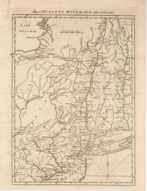
Great little map from this British periodical that was designed to familiarize the magazine's readers with the location of the hostilities in the American War. This map illustrates the region of the Hudson and Delaware Rivers and the marches of the armies under the Generals Howe, Clinton and Burgoyne. It covers New York and New England as far east as the Connecticut River, south to include Philadelphia, and north to encompass Crown Point and Ticonderoga. A nice example of this desirable Revolutionary War map.
References: Jolly GENT-257.
Condition: B+
Issued folding, now flattened. There is a tiny bit of faint foxing, else very good with wide margins.