Subject: North America
Period: 1829-1853 (published)
Publication:
Color: Hand Color
Nice lot of maps featuring North America. The lot includes:
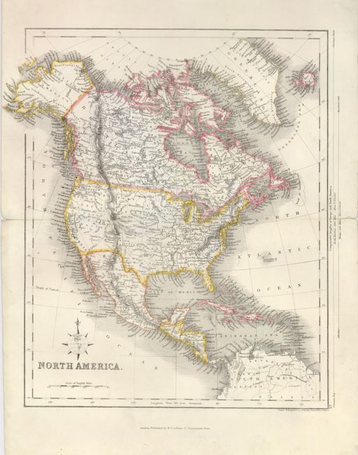
1. North America, circa 1853, H.G. Collins, London, HC, 9" x 11.2". The map features a pre-Gadsden Purchase border with Mexico and Alaska is Russian America. The west is occupied by a large Utah Territory that extends from the Great Desert north of Texas to California, and a huge unorganized area east of Oregon/Washington that reaches to Missouri Territory. Wisconsin is also named Huron. On thick paper with original outline coloring. Splits along centerfold on both sides with paper repair on verso. (B+)
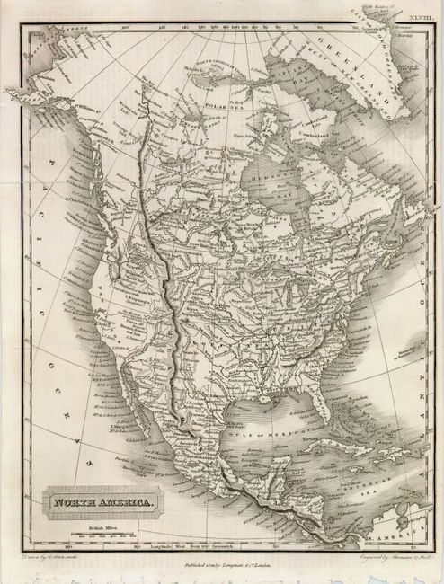
2. North America, 1829, A. Arrowsmith, London, BW, 8" x 10". This finely engraved map shows excellent detail for its date and is a tribute to Arrowsmith's cartography. There are numerous place names, topography, Indian tribes and more. The Rocky Mountains stretch in nearly a straight line from the Arctic Circle to Mexico, continuing to Panama. In the west, Las Vegas is located, Lake Trinpanogos is listed as "doubtful" and what must be the Great Salt Lake has the note: "The Western limits of this lake are unknown." (A+)
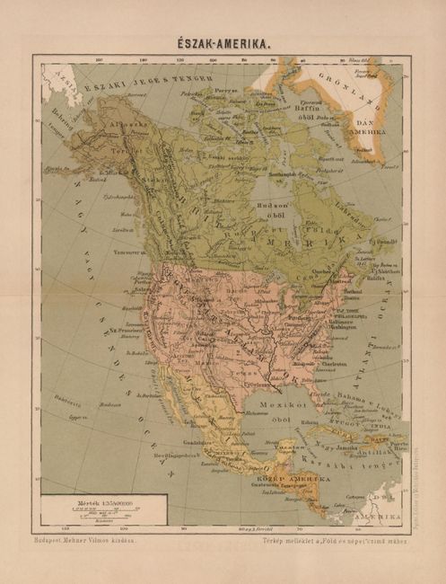
3. Eszak - Amerika, circa 1868, anon., Budapest, PC, 7.3" x 9.5". This map shows all the western states and territories of the United States, including Alaska. On thick paper with crease at centerfold, as issued. (A)
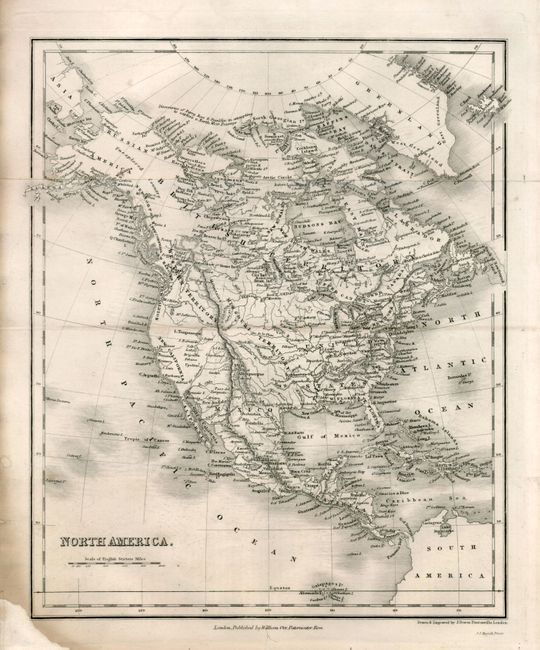
4. North America, circa 1836, William Orr, London, BW, 8.3" x 10". Alaska is Russian America, the Pacific Northwest is still called New Albion, the Southwest is New California, and the Baja is simply California. No political boundaries are shown in the west but there is very good detail of watershed; locates the Gila River, Great Salt Lake with the large Lake Timpanogas further north. Missouri Territory occupies the huge central area and the Western Territory extends from about Jackson Hole northwest and well into today's British Columbia. Folding as issued with a trace of toning along one fold. Lower left corner missing with professionally replaced paper just to corner of neatline. (B+)
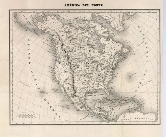
5. America del Norte, 1840, Barthelemier, Paris, b&w, 10" x 8.2". Very finely engraved map that shows Alaska as America Rusa, and Mexico in control of the Southwest. Texas is named (Tejas) and appears an independent. The Great Salt Lake is named L. Youta. (A).
References:
Condition:
See individual descriptions.