Subject: North America
Period: 1843 (circa)
Publication: A New General Atlas…
Color: Hand Color
Size:
14.2 x 18.2 inches
36.1 x 46.2 cm
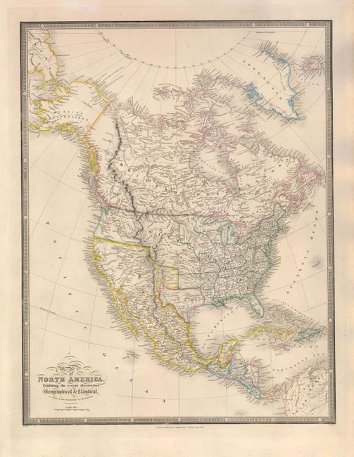
This finely engraved map is filled with superb details and prominently depicts the Republic of Texas. In the United States there is a large Iowa Territory, and the Oregon and Missouri Territories take in the entire West. Wyld introduced a number of new ideas concerning the watershed in the West with four great westward flowing rivers seeking the sea from the Great Basin. The most prominent is the Buenaventura River that flows from Salt Lake of Teguayo to the Pacific. Further north, the Sacramento River is shown to possibly flow from L. Yentaw noted as probably L. Timpanogos of the Spaniards. In Oregon, the R. de los Mongas and the McKinley Branch form the headwaters of the Willamette River. Alaska is denoted as Russian Possessions and Canada as British Possessions. The map is surrounded in bold keyboard-style borders.
James Wyld was successor to William Faden, one of the luminaries of late eighteenth century publishing in England. Wyld maintained the high standard of graphic and factual excellence that had been established by his predecessor and his maps are among the finest published in the early nineteenth century.
References: Wheat [TMW] #473.
Condition: A
There are a few faint spots mostly confined to blank margins of this sturdy sheet.