Subject: Southeast Asia
Period: 1730 (published)
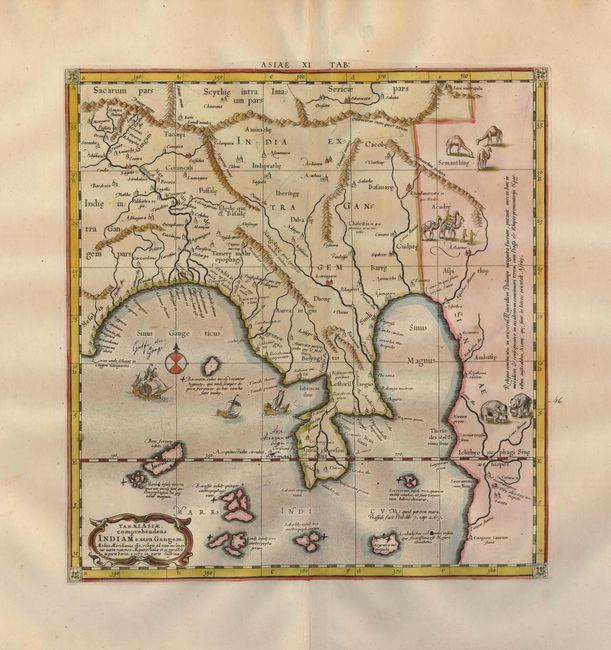
Publication: Claudii Ptolemaei's Atlas Tabulae geographicae Orbis Terrarum
Color: Hand Color
Size:
12.7 x 13.5 inches
32.3 x 34.3 cm
This great map illustrates the Ptolemaic concept of Malaya and Indochina, labeled India Extra Gangem or India beyond the Ganges. The map shows an oddly shaped Malaysian peninsula to the east of the Ganges, and the China Sea (Sinus Magnus), with a landmass to the east of that. The map hints at the Ptolemaic concept of a landlocked Indian Ocean, in which there are several large islands. Mercator originally published this map in his 1578 edition of Ptolemy's great Geography. Although he is most renowned today for the projection he popularized and for first using the term 'atlas' for a collection of maps, he devoted much of his life to his Ptolemaic maps. The maps were beautifully engraved as nearly as possible to their original form. The map is embellished with a galleon and two native boats, elephants, camels and a caravan vignette.
References: Mickwitz & Miekkavaara, (Nordenskiold-2) #235-17.
Condition: B
There are several ink notations and a couple of minor spots.