Subject: Holy Land
Period: 1750 (circa)
Publication:
Color: Hand Color
A very good grouping of attractive Holy Land maps.
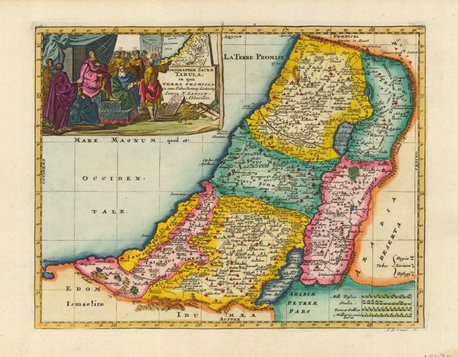
1) Geographiae Sacrae Tabula, in qua Terra Promissa… This is a reduced version of the elder Sanson's map of the Promised Land showing the Twelve Tribes of Israel. The title cartouche at the top left shows the map of Canaan presented to Joshua by his spies. Engraved by Antoine d' Winter, circa 1699. The map has later color and a good impression on a strong sheet with wide margins - Condition A (9.8 x 7.25").
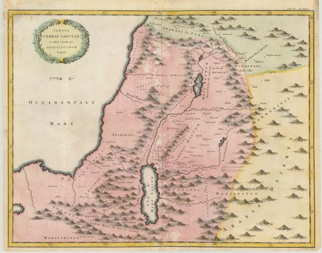
2) Tabula Terrae Sanctae in usum eorum qui Pentateuchum Legunt is an uncommon map of the Holy Land with simple place names and pictorial topography. It is anonymous, circa 1750. The map has later color on a sheet with some creases, a repaired tear in the sea and a small crescent-shaped tear to the right of the Moabitus. Condition B (14.5 x 11.25").
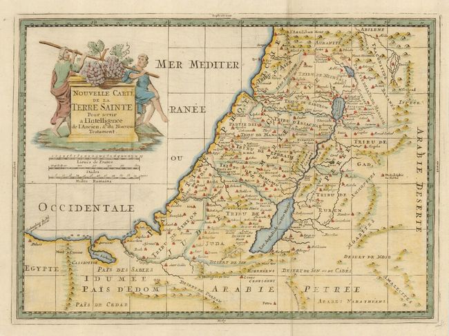
3) Nouvelle Carte de la Terre Sainte pour servir a l'Intelligence de l'Ancien, et du Nouveau Testament is an attractive map of the Holy Land with a nice cartouche featuring Moses' spies carrying the fruit from the Promised Land. The map is anonymous, and made circa 1750. The sheet is sturdy with some paper hinge remnants on the verso. Condition A (14.5 x 10.6").
References: 1) Laor # 693.
Condition:
See description.