Subject: Holy Land
Period: 1729-1750 (circa)
Publication:
Color: Black & White
An uncommon pair of maps of the Holy Land from the middle of the 18th century.
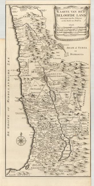
1) Kaarte van het Beloofde Land Ontworpen van den Schryver uit het Bock van Jozua is a detailed, scarce map of the Holy Land from Antioch to the mouth of the Nile. The title is displayed on a banner with four distance scales. Engraved by J. Keyser, circa 1729. The neatline on the right and left is partially gone due to a binder's trim. There is a 4" binding tear into the map on the left, repaired on the verso with paper. Condition B (9 x 18.1").
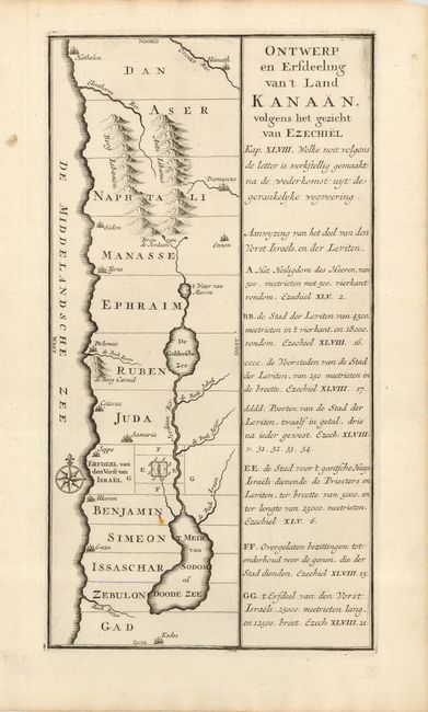
2) Ontwerp en Erfdeeling van't Land Kanaan volgens het Gezicht van Ezechiel is an unusual, anonymous map showing the division of the Holy Land among the Tribes of Israel, from the book of Ezekiel. The map is circa 1750. It is a good impression on a strong sheet with one rust spot to the left of the Dead Sea. Condition B+ (7.3 x 13.6").
References:
Condition:
See descriptions.