Subject: Eastern Mediterranean, Holy Land
Period: 1648-1688 (circa)
Publication:
Color:
A great pair of 17th century maps from Dutch bibles.
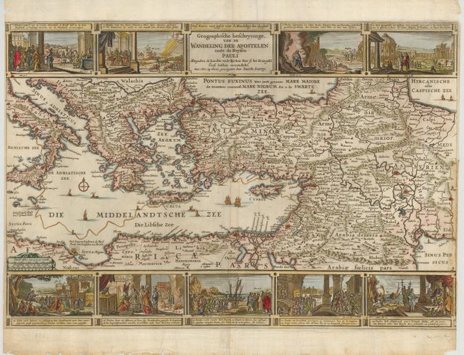
1) Geographische Beschryvinge van de Wandeling der Apostelen ende de Reysen Pauli portrays the Eastern Mediterranean from Rome through Asia Minor and the Holy Land. The route of Apostle Paul is charted from Sidon to Rome. Panels of Biblical scenes at top and bottom show the major events of his travels. Dutch text on verso. This map was made by Jacob Savry, circa 1648. It is hand colored, and it has margins that are chipped and close to the neatlines on the sides, and there are creases, and a repaired puncture in the central vignette at the bottom. Condition B (18.6 x 12.5").
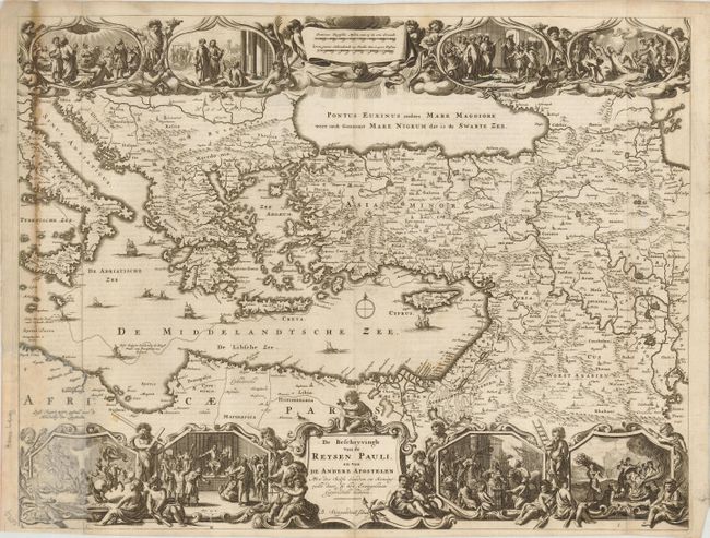
2) De Beschryvingh van de Reysen Pauli, en Van de Andere Apostelen is a decorative map of the eastern part of the Mediterranean adorned with vignettes showing episodes from the travels of St. Paul, compass rose and sailing ships. This map was engraved by Bastian Stoopendaal, circa 1688. Dutch text on verso. The map is uncolored, with some stains in the map, and the lower left corner (2.25 x 5") replaced in facsimile. Condition C+ (18.1 x 13.4").
References: 1) Laor #71; Poortman & Augusteijn #111; 2) Poortman & Augusteijn #146 K-I.
Condition:
See description.