Subject: Italy
Period: 1624 (published)
Publication: Parergon
Color: Hand Color
Size:
18.3 x 13.5 inches
46.5 x 34.3 cm
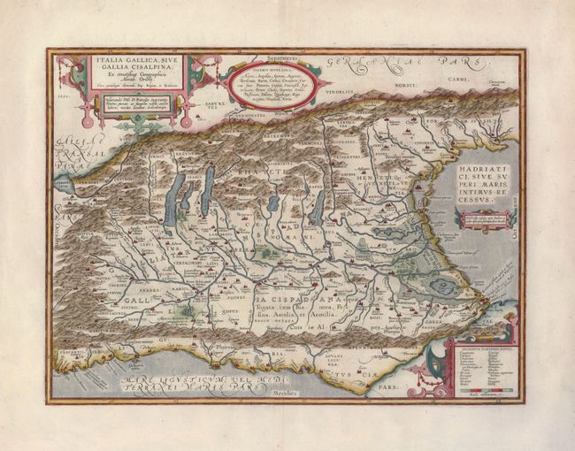
Handsome map of northern Italy showing the region during Roman times. The Roman road, Aurelia via Antonino, is shown along the southern coast and into the important marble quarry district. Ortelius based the map on classical sources including Livius, Ausonius, Tacitus, Cato, Linius, Polybius and Cassidore. Richly decorated with four strapwork cartouches. This is the second state of the map, with the Roman roads added along the coast. Latin text on verso and the Roman numerals XXV, indicating this map is from the 1624 edition of the Parergon.
References: Van den Broecke #206.2.
Condition: B+
An excellent impression on strong paper. There is a repair on the centerfold with tissue reinforcement on the verso.