Subject: Western Hemisphere
Period: 1650 (circa)
Publication:
Color: Hand Color
Size:
14.5 x 11.3 inches
36.8 x 28.7 cm
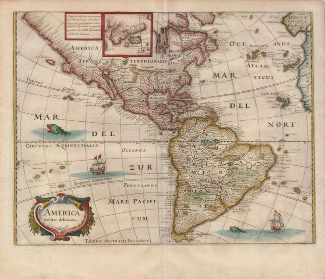
Merian prepared this reduced version of his 1631 map for the German translation of Pierre d'Avity's Les Empires du Monde and it accompanied other works of the period including Theatrum Europaeum. It is one of the many derivatives of Jodocus Hondius' map of 1618. North America is depicted with a prominent Virginia and an odd New England coastline. The western coastline above California makes the continent entirely too wide. There is only a hint of the Great Lakes. South America shows the mythical Parime Lacus on the equator, with the equally fictitious Manoa el Dorado (Golden City) on its shore. Greenland and Iceland are shown in an inset at the top of the map. Strapwork title cartouche, a sea monster and Spanish galleons decorate the map. Merian's signature at lower right.
References: Burden #251.
Condition: A
A superb impression on a sheet with a small area of thin papermaking above the 'M' in the Mar del Nort.