Catalog Archive
Auction 124, Lot 407

"Nouvelle Carte d'Angleterre, d'Ecosse et d'Irlande avec des Instructions pour Connoitre les Differents Etats de la Couronne d'Angleterre en Europe, Asie, Afrique, et Amerique", Chatelain, Henry Abraham

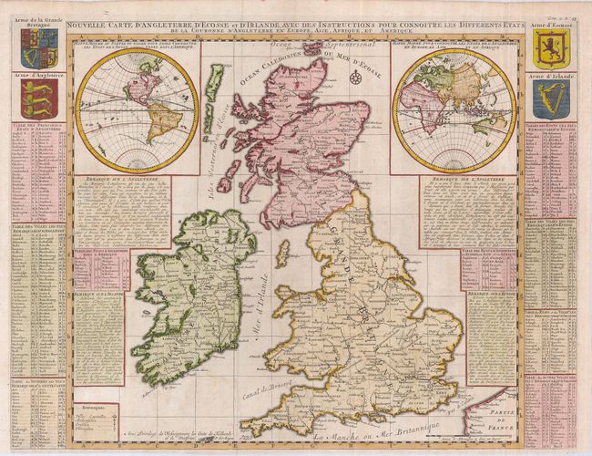
Subject: Britain, World

Period: 1710 (circa)

Publication:

Color: Hand Color

Size:
20 x 18 inches
50.8 x 45.7 cm
Download High Resolution Image
(or just click on image to launch the Zoom viewer)

This unusual map of the British Isles includes two large insets of the Western and Eastern Hemispheres. The Western Hemisphere exhibits the Island of California and a partial coastline of New Zealand. The Eastern Hemisphere shows only part of Australia. The large map of Britain is nicely detailed and the sheet includes numerous tables of relative information. At top left and right are the royal coats of arms of Britain, England, Scotland and Ireland.

References:

Condition: A

Issued folding, now pressed.

Estimate: $550 - $650

Sold for: $400

Closed on 5/7/2008

Archived