Subject: Greater Antilles
Period: 1650 (circa)
Publication: Atlantis Majoris Quinta Pars, Orbem Maritimum
Color: Hand Color
Size:
21 x 16.3 inches
53.3 x 41.4 cm
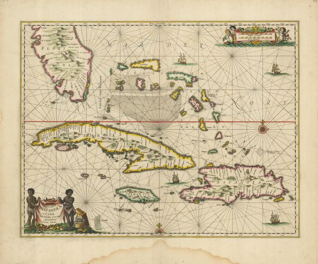
The first state of this striking sea chart that includes the southern tip of Florida, the Bahamas, Cuba, Jamaica and Hispaniola. It is one of the first Dutch maps to feature the region on a large scale, due to the importance of the "Canaal van Bahama" used to transport Spanish gold and silver from the New World. The cartography is based on the extremely rare Hessel Gerritsz chart of 1631, with the addition of five place names in Florida. Jansson also depicts a spurious mountain range in Florida, taken from the much earlier De Bry map. The map is embellished with a pictorial title cartouche and scale of miles, rhumb lines, galleons and two compass roses.
References: Burden #291.
Condition: B+
Lovely original color on a strong sheet with some marginal damp stains, and a very faint one entering the map at top.