Catalog Archive
Auction 124, Lot 329

"A New and Correct Map of the American Islands, now called the West Indies, with the Whole Coast of the Neighbouring Continent", Kitchin, Thomas

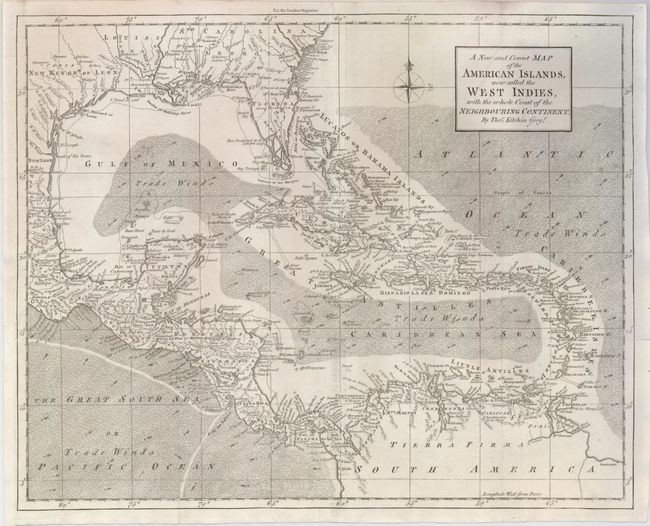
Subject: Gulf of Mexico and Caribbean

Period: 1762 (published)

Publication: London Magazine

Color: Black & White

Size:
13.8 x 11 inches
35.1 x 27.9 cm
Download High Resolution Image
(or just click on image to launch the Zoom viewer)

A finely engraved map of the Caribbean extending to include the southern United States and the northern coast of South America. It shows the sailing routes, and the directions of the trade winds are noted by hachure and arrows. Southern Florida is depicted as an archipelago of islands with interconnected waterways. Place names fill the map, particularly along the coast and in the islands. The Florida peninsula is truncated with the southern tip a mass of irregularly shaped islands.

References: Jolly LOND-216; Sellers & Van Ee #1692.

Condition: A

Issued folding, now flattened with tiny holes at a couple fold intersections and a pair of faint spots on the right side of the map.

Estimate: $300 - $375

Sold for: $200

Closed on 5/7/2008

Archived