Subject: United States, Texas & Mexico
Period: 1853 (dated)
Publication:
Color: Hand Color
Size:
24.8 x 20 inches
63 x 50.8 cm
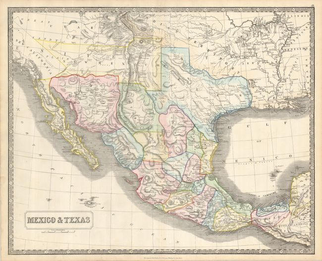
This map of the Southwestern United States and Mexico shows the border along the Gila River prior to the Gadsden Purchase, a transaction that occurred the same year as the map was published. The new state of Texas is well-detailed, and California is named as New California. The New Mexico Territory includes what would become Arizona and portions of present-day Nevada. Indian Territory stretches into the region that became Colorado, and Utah Territory sweeps all the way to California.
References:
Condition: A
A nice example with some faint toning and two pinholes in Texas that are only visible when the map is held up to strong light.