Catalog Archive
Auction 124, Lot 229

"A Plat Exhibiting the State of the Surveys in the State of Florida", U.S. State Surveys
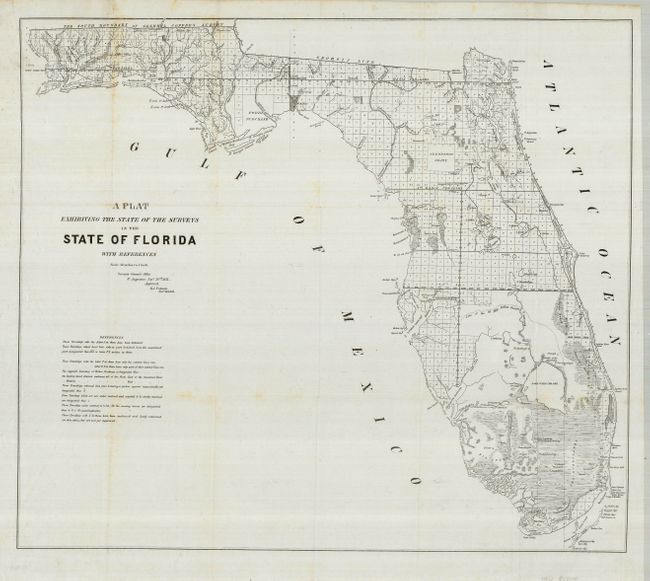
Subject: Florida

Period: 1851 (dated)

Publication:

Color: Black & White

Size:
24.8 x 21.6 inches
63 x 54.9 cm
Download High Resolution Image
(or just click on image to launch the Zoom viewer)

An interesting and detailed early lithographed map representing the state of surveying in the early years of Florida's statehood. The map clearly shows the Everglades, Big Cypress, the Northern Keys, as well as the Spanish land grants of Arredondo Grant, and the Forbes Purchase. The bottom left has a key with notes related to surveys and townships. Issued from St. Augustine by B.A. Putnam, Surveyor General.

References:

Condition: A

Issued folding, now flattened. The map has some very faint foxing. The margins have a couple of short tears, not affecting the map.

Estimate: $140 - $190

Sold for: $100

Closed on 5/7/2008

Archived