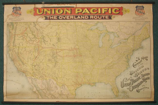
Subject: United States
Period: 1896 (dated)
Publication:
Color: Printed Color
Size:
53.5 x 35 inches
135.9 x 88.9 cm
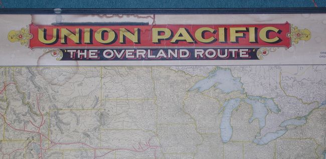
This uncommon wall map was issued by the Uniion Pacific Railroad as an advertising map. It shows the entire United States with the route of the Union Pacific Railroad depicted in bold black originating in Kansas City, Levenworth, St. Joseph, Omaho, Concil Bluffs, Sious City and Fort Worth. The rail extends to the west coast and the Pacific Northwest with a large network in and around Denver. At either side of the large title in red and yellow are the company's logos. The map is titled with fancy calligraphy typical of the period, and above the map is a second title in a decorative header printed in red, blue, and yellow: Union Pacific - The Overland Route.
References: Modelski #598.
Condition: A
In remarkable condition for a map of this type with the original rails and vivid colors. There are a few damp stains, one of which caused the black paint of the rail to transfer to the top of the header above the map. There are a few minor cracks.