Subject: Exploration and Surveys
Period: 1861 (published)
Publication: 36th Cong., 2d Sess.
Color: Black & White
Size:
9 x 11.8 inches
22.9 x 30 cm
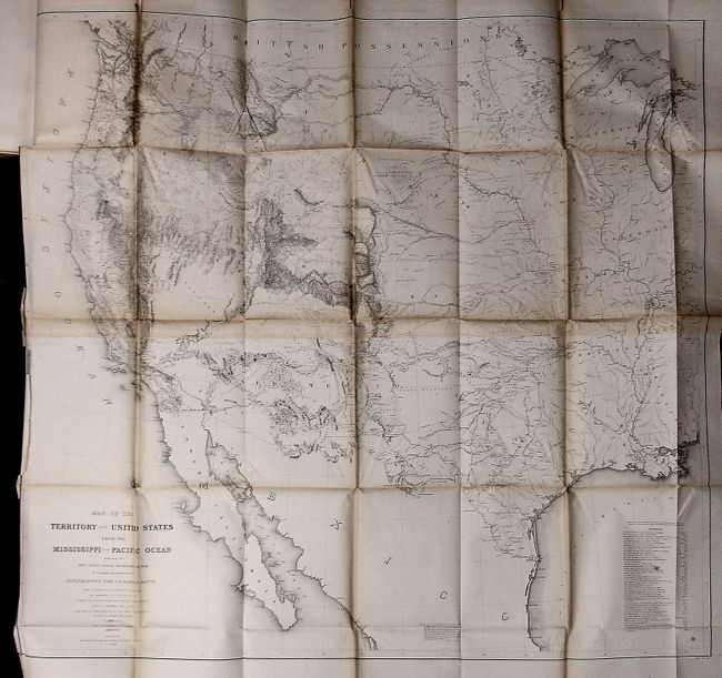
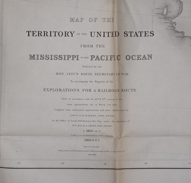
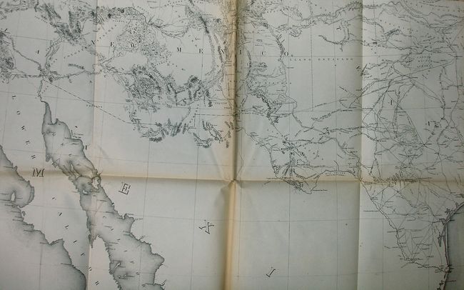
This is the unnumbered Senate version specifically noted in the reference given. This volume includes the rare Warren map, "Map of the Territory of the United States from the Mississippi to the Pacific Ocean…," (46" x 42") which was not present in all volumes. Known as "Warren's General Map," this is a monumentally important map that is considered to be the first accurate overall picture of the region. Wheat (TMW #936) considered it so important that he dedicated eight pages to its description and called it the most important map produced by the Topographical Engineers. Drawn on the polyconic projection, the map culminated a half-century of government explorations beginning with Lewis and Clark. Only 24 years old when assigned the task, Warren used information from the U.S. Land Office, the Coast Survey, Topographical Engineers, the Adjutant General, the Quartermaster General, the Indian Bureau, and Smithsonian Institution to obtain the latest information in developing this map. The majority of the map was completed by 1854, but it was not fully complete when the first railroad survey report was published in 1855 and thus did not accompany all editions. A remarkable and scarce map that represents the best geographical knowledge of the day.
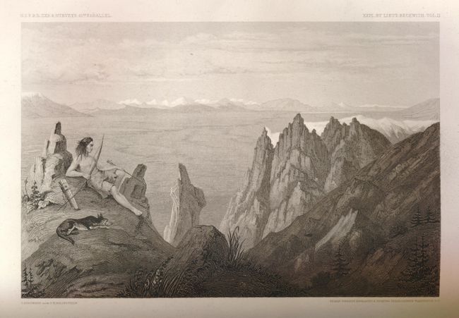
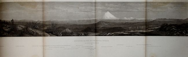
In addition to the Warren map in this complete volume, we count a total of 32 large folding maps, but have not opened any save the Warren map to verify its inclusion. All appear to be quite clean and sound, with a few binding trim tears and other slight flaws inherent in these large maps. Also having to do with the 41st Parallel survey, it includes the beautifully engraved plates and panoramas from Lieut. Beckwith's explorations from Salt Lake City to the Sacramento River . Includes the "Northern Slopes of the Sierra Nevada" which has a dramatic view of Mt. Shasta. This is a complete Volume XI in as fine condition as we've ever seen. There are obviously some other important maps present, please call with specific questions.
References: Wagner & Camp #266
Condition: B+
A really lovely example of this rare issue, which is the best copy we've seen. Although we have not opened the maps, they all appear in very good condition or better. Covers are a little rubbed.