Subject: Atlases
Period: 1854 (dated)
Publication:
Color: Hand Color
Size:
14.5 x 17.3 inches
36.8 x 43.9 cm
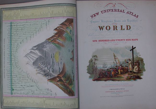
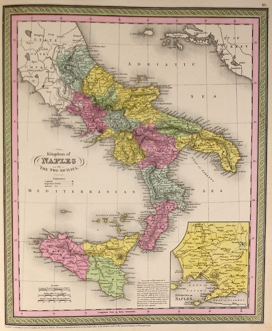
The title continues "With a special map of each of the United States, Plans of Cities &c. Comprehended in seventy five sheets and forming a series of one hundred and twenty nine Maps Plans and Sections." This is an unusually fine copy of this famous and highly sought after atlas, complete with 75 hand colored maps of the world, North America and the other continents, Oceanica, the United States and its territories, and numerous city plans. All are in very fine original hand coloring.
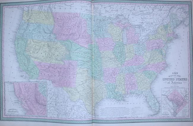
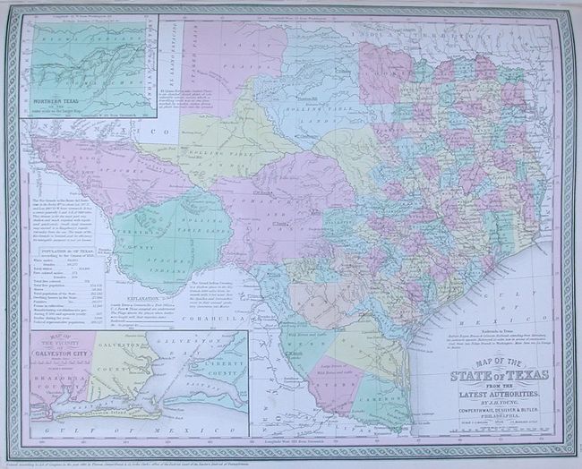
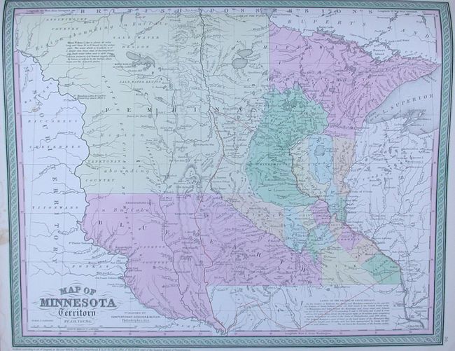
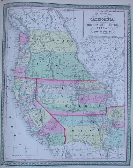
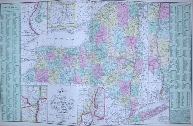
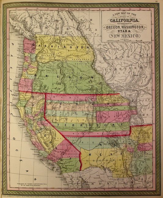
The atlas concentrates mainly on the American continent, and features many important and desirable maps including Map of the State of Texas, a fine double page A New Map of the United States of America, and a double page Map of the State New York Compiled From the Latest Authorities. The spectacular map of the west has Oregon and Washington extending to the Continental Divide, the huge Utah territory extends from California to Indian Territory, and New Mexico occupies all of the Southwest with a pre-Gadsden Purchase border. The double page map of the United States features the same border depicts in the west, plus it has a large inset "Gold Region of California." The map of Minnesota features the large territories of Pembina and Blue Earth extending to the Missouri River. The frontispiece is a hand colored, engraved diagram showing the lengths of rivers and heights of mountains. The title page includes a fine chromolithographic image titled "First Landing of Columbus in the New World." With the unnumbered city plan of Philadelphia. Double page maps include the United States, New York, and Europe.
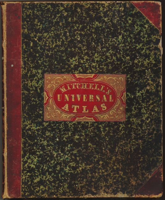
Samuel Augustus Mitchell and his sons were the leading publishers of maps in the United States during most of the nineteenth century. Mitchell had come to Philadelphia around 1830 with the intention of improving the standard of geography textbooks. A New American Atlas, published in 1831, was his first work. Then, in 1845 he acquired the rights to Tanner's New Universal Atlas, and in 1846 he published his first edition of the present work. Mitchell continued to publish the atlas until 1850, when he sold the copyright to Cowperthwaite & Co. of Philadelphia, who continued to publish it until the mid-1850s, when it was purchased by Charles DeSilver.
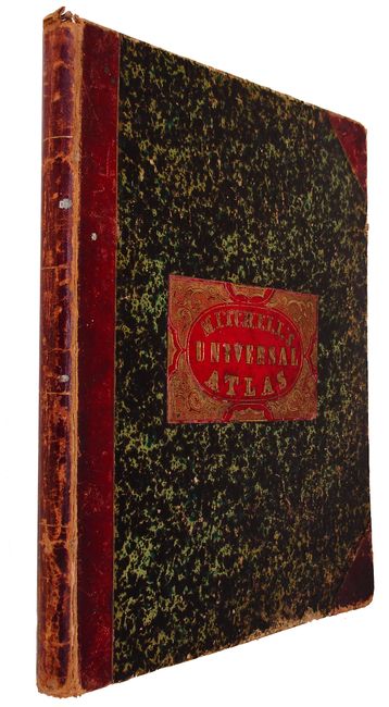
Hardbound, frontis, chromolithographed pictorial title page depicting Columbus' arrival in the New World, table of contents printed in red and gilt color, 75 map sheets comprising three double page and 69 single page hand colored maps. Bound in original marbled paper with red leather tips and spine. Red leather label on front cover with gilt title and design. Published by Cowperthwaite, DeSilver & Butler, No. 253 Market Street, Philadelphia. This is really fine example of an increasingly difficult to find atlas.
References: Ristow pp. 303-313; Phillips (A) #813 & 814.
Condition: A
All pages and maps are in very good to fine condition. Front cover is reattached with binding tape. The covers and spine are very good with light rubbing and wear, particularly to extremities. Spine a little more worn. Old book plate on inside cover and previous owner's signature on first blank end paper.