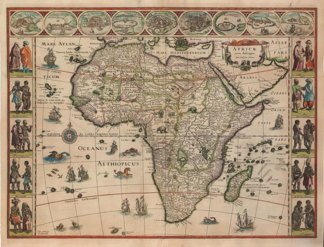
Subject: Africa
Period: 1630 (circa)
Publication: Atlas Novus
Color: Hand Color
Size:
21.8 x 16.3 inches
55.4 x 41.4 cm
This is one of the most decorative seventeenth century maps of the African continent and a superb example of the Dutch carte-a-figures style. The map is surrounded on three sides with vignettes of native peoples and nine principal cities. The Nile is shown according to Ptolemy with its sources arising in the lakes Zaire and Zaflan, the fictitious Lake Sachaf of Laurent Fries appears, as well as the R. de Spirito Santo. The map is further embellished with numerous ships, sea monsters (including a great seahorse), a compass rose and exotic animals wandering all over the continent. This is the second state of the map. Latin text on verso.
References: Betz #57.2; Norwich #32.
Condition: B+
A fine impression on a sheet with original coloring. There are a few printer's creases, and the centerfold and a few marginal areas have been professionally reinforced with the leaf-casting method on the verso.