Subject: World
Period: 1874 (dated)
Publication: New General Atlas
Color: Hand Color
Size:
10 x 13.8 inches
25.4 x 35.1 cm
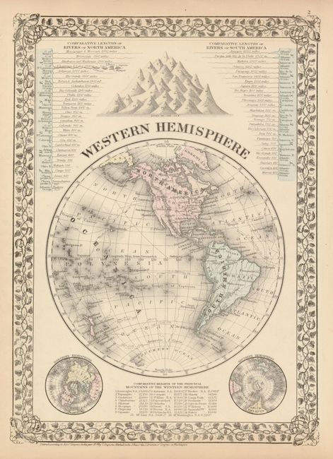
The Western Hemisphere map includes two smaller maps of the Northern and Southern Hemispheres, as well as comparisons of the heights of mountains and lengths of rivers. The map shows the tracks of Capt. Cook from his expeditions in 1773 and 1774. A hint of Antarctica appears as "Victoria Land".
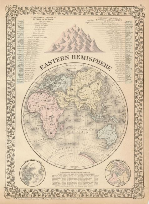
TheEastern Hemisphere map has two smaller maps displaying the Greatest Mass of Water, and the Greatest Mass of Land, as well as comparisons of the heights of mountains and lengths of rivers. The continent of Antarctica is named, and the map shows the tracks of Cook and Capt. Gore's 1780 expedition.
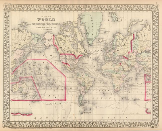
On the verso of the Eastern Hemisphere is the double page Map of the World on the Mercator Projection, Exhibiting the American Continent As Its Centre shows the tracks of numerous explorers, including Cook, Gore, and Ross. Telegraph cables between the eastern U.S. and Europe are illustrated. (18" x 14") The maps on two sheets.
References:
Condition: B+
Maps have some chipping along a couple edges. There are several, short edge separations, two repaired with archival tape on verso.