Catalog Archive
Auction 123, Lot 511

"Thom. Baroni… Galliae et in Britannico Mari Insularum", Mela, Pomponius

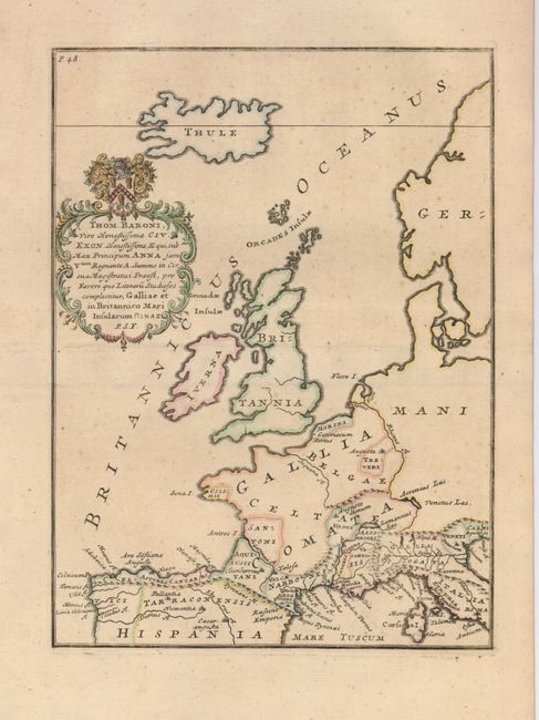
Subject: Western Europe

Period: 1711 (published)

Publication: Pomponii Melæ de situ orbis libri tres…

Color: Hand Color

Size:
7.3 x 9.8 inches
18.5 x 24.9 cm
Download High Resolution Image
(or just click on image to launch the Zoom viewer)

A fascinating map of western Europe from an edition of Pomponius Mela's geography, published in 1711 by the Exeter scholar John Reynolds. The map includes the British Isles and extends to the island of Thule in the approximate location of Iceland. It has simple topography and ancient place names, and the decorative cartouche is dedicated to Thomas Baron.

References:

Condition: A

A nice impression with a few faint spots, still very good.

Estimate: $130 - $160

Sold for: $160

Closed on 2/20/2008

Archived