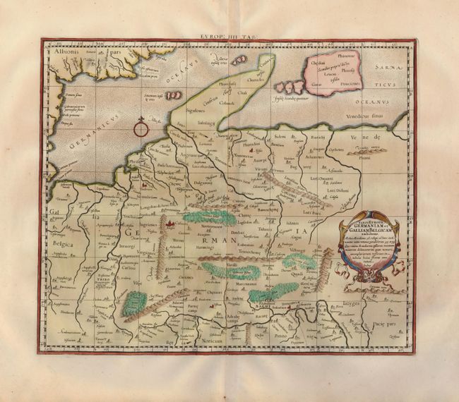
Subject: North-central Europe
Period: 1730 (published)
Publication: Claudii Ptolemaei's Atlas Tabulae geographicae Orbis Terrarum
Color: Hand Color
Size:
16 x 13.3 inches
40.6 x 33.8 cm
This fine map of ancient Germany is beautifully engraved to illustrate the topography and cities and embellished with a strapwork title cartouche. The most striking feature of the map is the depiction of Denmark as a non-descript finger of land and a group of islands including one very large one labeled Scandia proprie dicta. Mercator originally published this map in his 1578 edition of Ptolemy's great Geography. Although he is most renowned today for the projection he popularized and for first using the term Atlas for a collection of maps, he devoted much of his life to his Ptolemaic maps. The maps were beautifully engraved as nearly as possible to their original form and embellished with fine cartouches.
References: Mickwitz & Miekkavaara, (Nordenskiold-2) #235-22.
Condition: A
A nice impression on fine laid paper with generous margins.