Catalog Archive
Auction 123, Lot 480

"Murs Comitatus [on sheet with] Regionum Urbium et Fluminum que Potissimu Comitatum Murs Ambiunt Brevis Descriptio", Mercator/Hondius

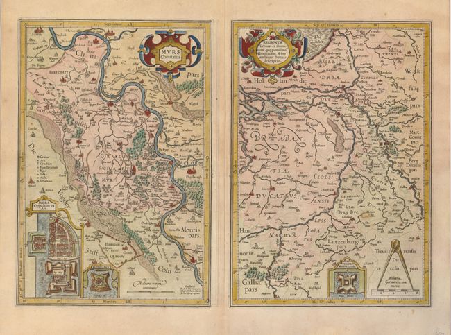
Subject: Northern Europe, Netherlands and Germany

Period: 1630 (circa)

Publication:

Color: Hand Color

Size:
20.3 x 14 inches
51.6 x 35.6 cm
Download High Resolution Image
(or just click on image to launch the Zoom viewer)

Two maps on one sheet, both with decorative strapwork cartouches. The map on the left shows the course of the Rhine River in Westphalia from Xanten (Santen) , past Duisberg to Cologne. It is inset with maps of the plan and fort at Murz. The second map shows route of the Rhine on its exit into the ocean near Rotterdam, where it meets the Meuse River. It is inset with a plan of the fortifications of Middelaer.

References:

Condition: B

Both with strong impressions. The second map has a small repair to the right of Limburg, with paper replaced.

Estimate: $200 - $250

Sold for: $160

Closed on 2/20/2008

Archived