Subject: English Channel
Period: 1740 (circa)
Publication:
Color: Hand Color
Size:
10.7 x 8 inches
27.2 x 20.3 cm
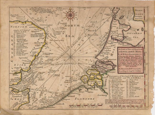
A nicely detailed chart showing the English Channel and North Sea, from information given to Moll by Captain G. Collins. Sea routes from England to Holland, France and Flanders are noted, as are soundings, shoals and other navigational hazards. There are historical notes, including the landing of King William in Yarmouth in 1694, as well as the loss of a Gloucester man o' war on the Lemmon Sand in 1682. The delicately engraved compass rose orients the map at top.
References:
Condition: C+
The map is toned and foxed, and has some insect damage in the right margin, just past the neatline. There are a few edge separations, two repaired with framer's tape on verso. A centerfold split at the top margin has been repaired with archival tape on verso.