Catalog Archive
Auction 123, Lot 458

"Wassende Graade Kaart van de Noord Oceaan van Terra Nova en de Straat Davids en Hudsons…", Keulen, Johannes van

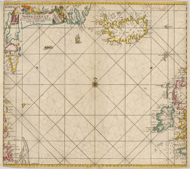
Subject: Arctic Canada, Greenland and Iceland

Period: 1692 (dated)

Publication: De Nieuwe Groote Lichtende Zee-Fakkel…

Color: Hand Color

Size:
23 x 20.3 inches
58.4 x 51.6 cm
Download High Resolution Image
(or just click on image to launch the Zoom viewer)

An uncommon sea chart of the North Atlantic, including Ireland, Iceland, a portion of the coasts of Greenland, Newfoundland, Scotland and England. Loxodromic lines emanate from a compass rose in the center of the map, and a sailing ship and fishing boat ply the sea. The title cartouche shows various types of natives engaging in trade, and some local sea birds.

References:

Condition: B

A dark impression on a double-thick sheet. The right and left side of the map have paper added, with some facsimile of the latitude lined on the lower right. There is a light damp stain in the top of the map.

Estimate: $700 - $900

Sold for: $550

Closed on 2/20/2008

Archived