Subject: Puerto Rico
Period: 1898-99 (dated)
Publication:
Color: Printed Color
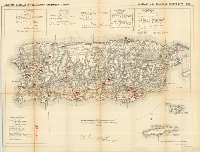
Pair of folding maps of Puerto Rico. The first is a great Spanish American War map that uses colored flags to show the location of U.S. and Spanish forces. The map itself is uncolored so the colorful overprinted flags appear nearly three dimensional on the sheet. Details include scores of towns and villages, roads, railroads, cart roads, and horse trails. The hills and mountains are shown in extensive hachure. Above the map is a comprehensive listing of all military deployments with the commanding officer named. Large inset map at lower left details the Isla Culbra and Isla de Vieques. Signed in the plate by W.M. Black, Lt. Col. Chief Engineer. Drawn by W. Morey Jr., C.E. and published by the Adjutant General's Office, Military Information Division. A most desirable and detailed Spanish American War map that is drawn on the scale of 1inch to 4 miles. (28.5" x 21") Ref: Phillips (M) p.720. A little fold toning, more so on one fold. (B)
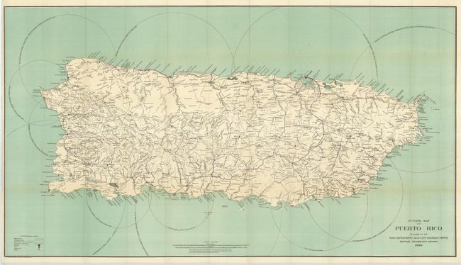
The second is a large map that also shows the entire island. It is filled with details to include the roads, trails, towns and villages, railroads, lighthouses, watershed and more. The map is black and white with a fully colored ocean surrounding. (49.5" x 28) Near fine (A) less a trace of very light fold toning.
References:
Condition:
See descriptions.