Subject: World
Period: 1730 (circa)
Publication:
Color: Hand Color
Size:
18 x 14.5 inches
45.7 x 36.8 cm
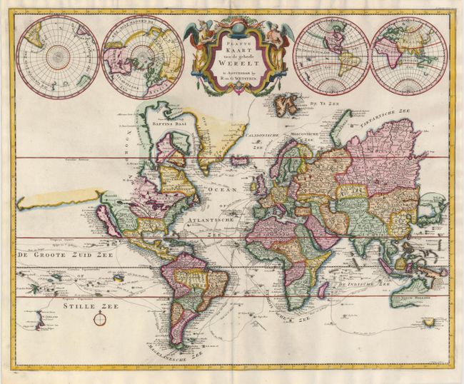
This unusual map of the world is derived from Pierre Mortier's Carte General du Monde of 1700. The map is on Mercator's projection and depicts California as an island. Above the island, the coastline stretches directly west ending just at the map's border. The northeast coastline of Asia is lacking Kamchatka and Japan is depicted connected to 't Land van Yedso (Hokkaido). Australia and New Zealand are only partially mapped. Numerous exploration routes are shown with their respective discoveries, including Tasman, Spilbergen, Columbus, Hudson, Dampier, Magellan and others. Two additional double hemispheres, including one on a polar projection, flank the decorative title cartouche that includes two angels. Engraved by J. Keyser.
References: Shirley #622.
Condition: A+