Subject: United States, Texas & Mexico
Period: 1814 (dated)
Publication: New General Atlas
Color: Hand Color
Size:
24.8 x 20.5 inches
63 x 52.1 cm
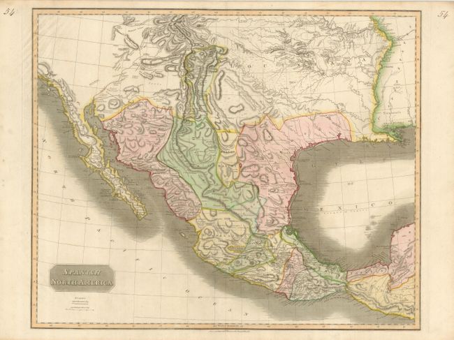
Large, significant map depicting the Spanish possessions in North America. The Spanish claim extends from Guatemala to the Louisiana Territory, which encompasses the area from Santa Fe to the Mississippi and from the Missouri River to near Gulf. Especially noteworthy is the delineation of the great river systems, particularly the Platte flowing east and south of the Rocky Mountains. According to Wheat, the map originated primarily from the epic Humboldt and Pike maps and to some extent the Pinkerton and Arrowsmith maps published a few years earlier. Texas appears within the province of St. Louis de Potosi. The map names many Indian tribes and villages.
References: Wheat (TMW) #320.
Condition: A
A strong sheet with original color. Upper left corner with a little minor soil, still very good.