Subject: Wisconsin
Period: 1836 (dated)
Publication: Senate. Doc #175, 25th Congress 2nd Session
Color: Black & White
Size:
20 x 14 inches
50.8 x 35.6 cm
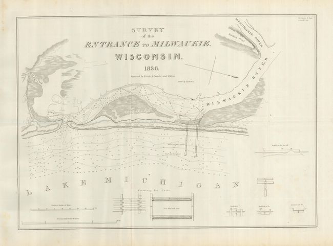
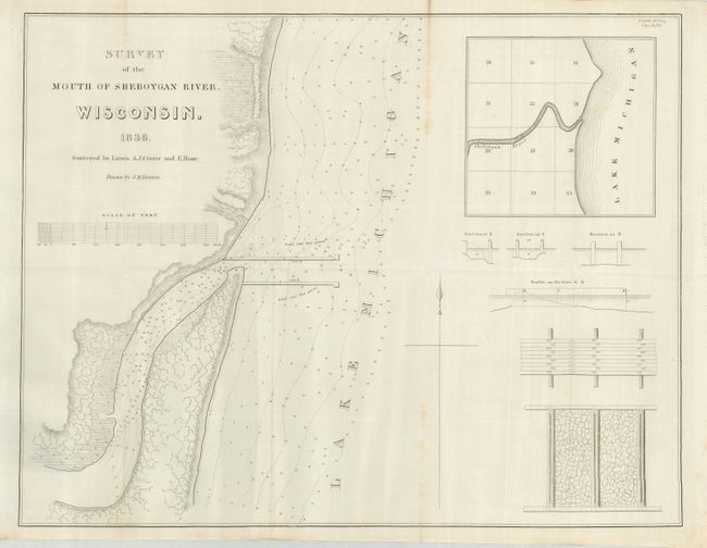
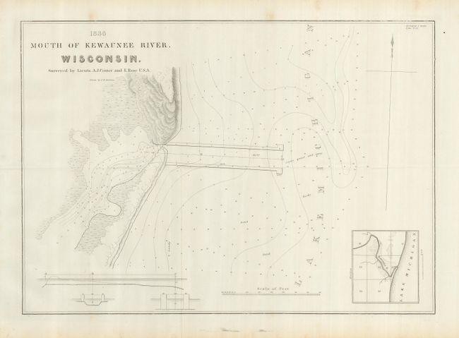
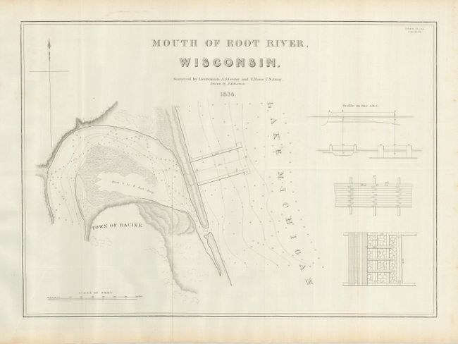
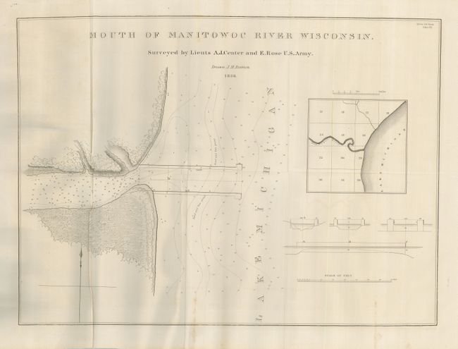
Lot of five early folding charts that were surveyed by Lieuts. A. J. Center and E. Rose. Each is dated 1836, with slight variation to size given.
1) Survey of the Entrance to Milwaukie, Wisconsin. Locates Bois Gris Creek, Walker's Point and the Menomonie River.
2) Survey of the Mouth of the Sheboygan River, Wisconsin. Chart of the river mouth which empties into Lake Michigan at the location of the present-day city of Sheboygan. This is the first chart of the vicinity of the city.
3) Mouth of the Kewaunee River, Wisconsin. This is the first printed plan of the Kewaunee City area. It gives good detail of the constructed waterway into Lake Michigan, but no sign of any settlement at this point. Inset of the area.
4) Mouth of the Root River, Wisconsin. Locates the town of Racine without showing any streets or buildings.
5) Mouth of the Manitowoc River Wisconsin. 900-foot long breakwater is shown. Smaller images include cross-sections of the breakwater and a regional inset.
References: Claussen & Friis #195, 197, 193, 194 & 198.
Condition: B+
All folding, as issued. With full, original margins. All are B+ or better.