Subject: Washington
Period: 1855-57 (dated)
Publication:
Color: Black & White
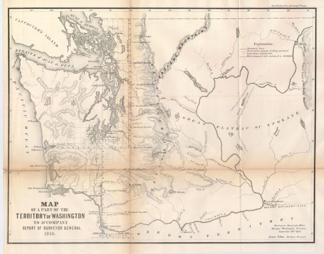
1) Map of Part of the Territory of Washington to Accompany Report to Survey General, General Land Office, Washington, 1855. This uncommon map was executed by James Tilton, Surveyor General, from the Olympia office. This is the first GLO map of Washington Territory, issued just 28 months after its creation. The map shows limited survey progress with modest detail west of the Cascades. In the east, only major rivers are shown. Several forts (Steilacom, Nisqually, Walla Walla, and Townsend) are located and Seattle is labeled Statle. Legend at upper right identifies surveyed lines, surveys under progress, townships subdivided, and proposed surveying for the 1856 and '57 season. This historical and infrequently offered map is well-drawn on a scale of one inch equal to 18 miles. (19 x 14.8") Archival tape repairs on verso to support fold weakness and splits. Browning along folds. (B)
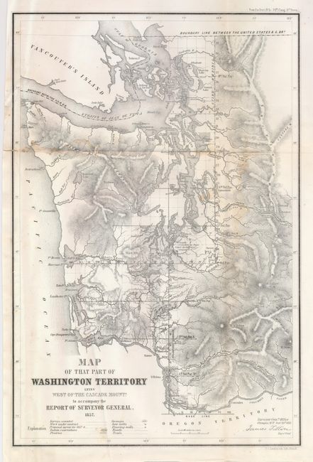
2) Map of That Part of Washington Territory Lying West of the Cascade Mounts. To Accompany the Report of Surveyor General, General Land Office, 1857. Philadelphia, Duval. This detailed map shows the western third of the state delineating early development along the Columbia River and Puget Sound. Also shown are Indian reservations, prairies, swamps, saw mills, flouring mills, roads, trails and lighthouses. Surveyed by James Tilton and lithographed by Wagner & McGuigan, Philadelphia, 1857. Signed in the plate by Tilton in Olympia. (10 x 15") A nice example less an area of light damp staining along one fold. (B)
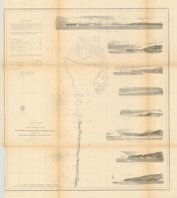
3) (No. 7) Reconnaissance of the Western Coast of the United States (Northern Sheet) from Umpquah River to the Boundary. U.S. Coast Survey, 1855. This chart delineates the coast from the first official scientific reconnaissance of the Pacific coast. This map is one of three prepared by Lieutenant James Alden for this important survey. It covers the region from the Canadian Boundary and the Straits of Juan de Fuca to several miles south of the mouth of the Umpquah River. It outlines the coastal littoral, shows dangerous reefs and shoals, gives offshore bathymetric soundings, plus general and specific harbor sailing instructions. The most impressive feature are the eight views of entrances and promontories along this rugged coastline - among them Flattery Rocks, Destruction Island, Tillamook Head, Cape Lookout, and the imposing entrance to the Columbia River at Cape Disappointment. The map was drawn by W.M. McMurtie. (22.3 x 24.5") Few splits repaired on verso with archival tape. Two small fold intersection fold splits with minor loss.
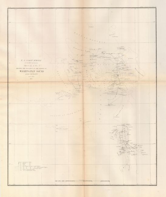
4) Sketch J. No. 3 Showing the Progress of the Survey of Washington Sound and Vicinity, U.S. Coast Survey, 1855. ( 13.3 x 15.8") Slight browning along folds. (B)
References:
Condition:
All folding as issued. See description for further condition information.