Subject: Virginia
Period: 1876 (published)
Publication:
Color:
Size:
6.5 x 9.7 inches
16.5 x 24.6 cm
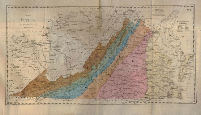
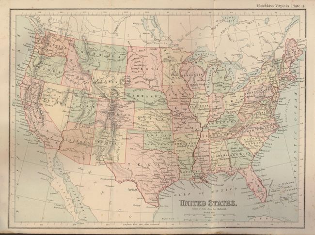
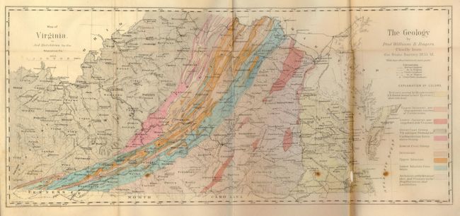
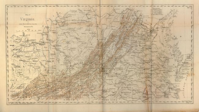
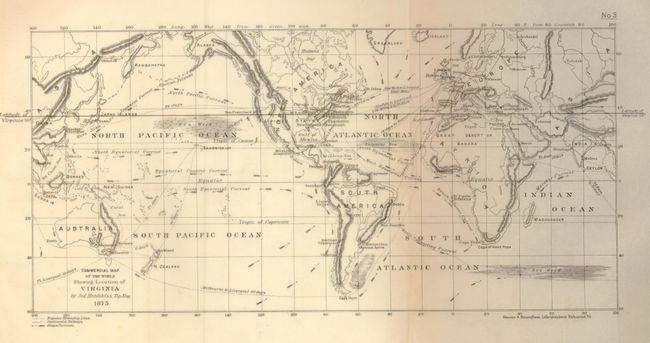
This is a very uncommon reconstruction-era publication produced by Virginia's Board of Immigration intended to attract people to the state, and encourage redevelopment following the Civil War. It is filled with political and geographical information and extensive descriptions of Virginia's natural resources and cultural advantages. The board selected the former Confederate cartographer, Major Jed. Hotchkiss to do the summary and some of the cartography for the project. There are three fold-out maps of Virginia, with attractive hand-coloring, printed on thin banknote paper: a physiographic map (19 x 10") showing railways, canals and courthouses in addition to the natural divisions, a geological map (22 x 10") that was produced by Prof. William B. Rogers using the findings from the survey done from 1835 - 1841, and a topographical map (18 x 10") that shows the elevations in brown overprinting. Additionally, there are two smaller maps of the United States and the World (showing the favorable commerical location of Virginia). The geological map is significant as being the first published geological map of Virginia issued by the state. 8vo. 319 pages. Softbound with original grey paper covers and printed title. Printed in Richmond by George W. Gary and published by the Commonwealth of Virginia.
References:
Condition: B
The geological map has some loss along the outside fold that affects Norfolk County. Other maps good to very good with a bit of minimal foxing. Covers and spine worn with minor loss and insect spotting to back cover and spine.