Subject: Texas
Period: 1867 (dated)
Publication:
Color: Hand Color
Size:
13.5 x 10.75 inches
34.3 x 27.3 cm
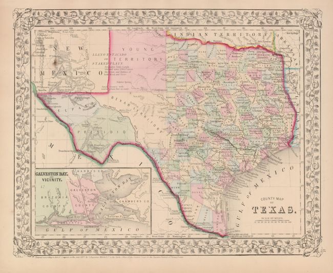
One of the most attractive maps of the state of Texas, inset with a map of Galveston Bay and Vicinity. West Texas is made up of Young Territory, Bexar Territory, El Paso and Presidio Counties. The map clearly shows the Llano Estacado or Staked Plain with a notation about the region being "destitute of both wood and water." Trails and roads are shown and limited railroads extend only into Austin. Numerous dashed lines indicate proposed railroads. The map is surrounded by a finely engraved leaf and grape border. Dated 1867, the county development is up-to-date for 1864 as Dawson county, abolished in 1866, is included.
References:
Condition: A
A beautiful example with full margins and fine original coloring. One small spot in upper left corner.